
Boaties have been urged to be careful when crossing a coastal bar, with footage showing just how difficult it can be.
Helmsmen were advised by Coast Guard and the Department of Transport and Main Roads to be wary of conditions when they head out to sea via the Bribie bar.
The bar became the main gateway to the ocean for boats from Caloundra, Golden Beach and Pelican Waters after a tidal breakthrough split Bribie Island in two early last year.
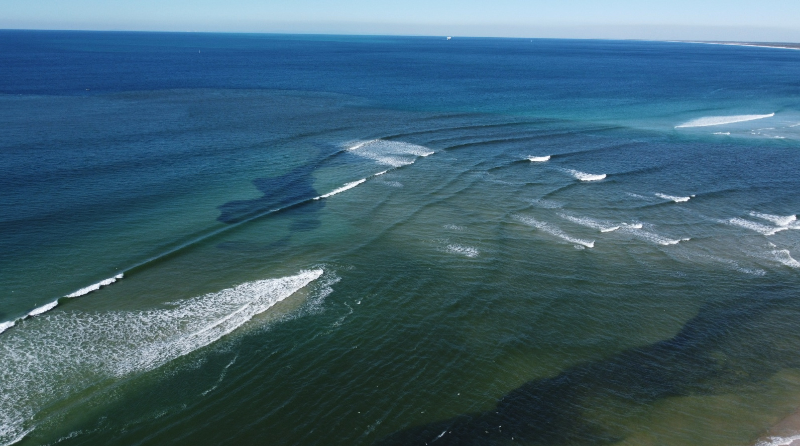
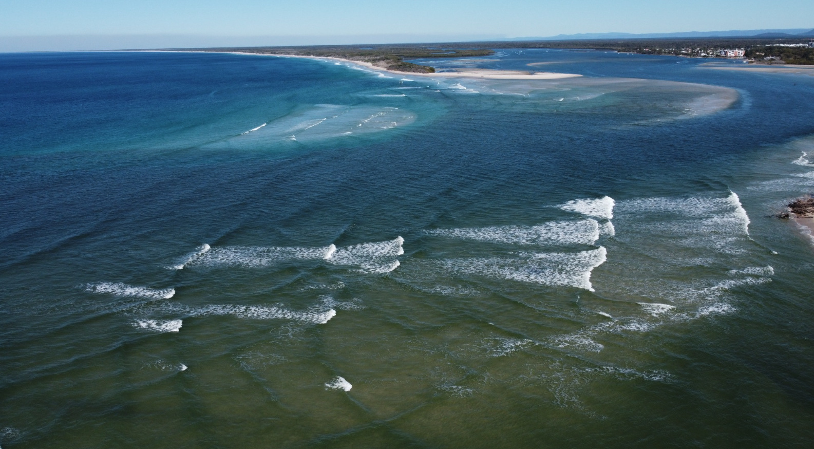
But the crossing has continued to change and powerful waves have been seen breaking on its eastern edge in recent weeks.
Caloundra Coast Guard commander Roger Pearce said boaties should be wary of conditions there.
“The problem is that you think you’re across the bar but the sand is now actually 300m to 400m further out to sea and the waves aren’t standing up until the very end,” he said.
“You’ve got to be cautious as you get closer to sea that a wave doesn’t just stand up in front of you, which is what happened to us.”
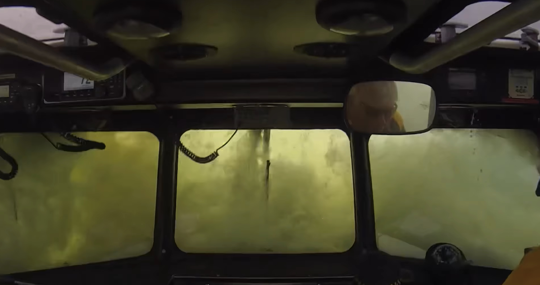
Caloundra Coast Guard staff posted footage of one of their vessels crashing into large surf.
In the video – viewed more than 45,000 times – the boat’s deck and cabin are swamped by one huge wave.
Coast Guard also posted a video of a boatie weaving a vessel through the surf and riding over rapidly emerging waves.
The drone video showed the boat going though the split in the island with ease, before encountering hidden sand and oncoming waves.
“He was heading out quite normally at the beginning but then has to zig-zag to dodge a few waves at the end,” Mr Pearce said.
The potentially dangerous conditions have arisen just ahead of the opening of a multimillion-dollar marina at Pelican Waters this month.
“A big issue for boaties in the public (based at the marina) is that they are going to have full access to the sea but as they get to the new Bribie bar, there is this big build-up of sand out to sea,” Mr Pearce said.
“People will think they are crossing the bar at the landline (the split in the island) but in fact the bar goes hundreds of metres further out and there can be massive waves breaking over them.
“It’s a real education program that we’re going to have to develop (because) it’s something that could be a major problem.”
Mr Pearce said little could be done to change the situation, other than to make boaties aware of the “sand delta”.
“It’s just nature taking its course, with sand from the (Pumicestone) Passage building up there,” he said.
A spokesperson for Transport and Main Roads said coastal bars were unpredictable.
“Coastal bar conditions are dynamic and change frequently due to environmental factors,” they said.
“Since the Bribie Island bar formed, the best course to cross has changed significantly.”
The spokesperson said “many vessels are safely crossing the Bribie Island bar” but “boaties should always be wary of crossing any coastal bar”.
“Obtaining local knowledge is very important and can often be gained by contacting the local Marine Rescue or Coast Guard unit,” they said.
“It’s compulsory for everyone to wear a lifejacket while crossing designated coastal bars in open boats under 4.8m.”
A before and after photo of the island, via Australian location intelligence company Nearmap, shows just how much it changed from September 2021 to May 2023. The island was intact but there is now the large breakthrough, forming the Bribie Bar.
Aerial imagery by Nearmap
TMR said navigation aids were established near the new bar, after another sand bar formed across the Pumicestone Passage.
“These aids were established to supplement the updated Notice to Mariners, to inform boaties that the former channel (within the passage) had shoaled,” the spokesperson said, before adding that the region was being monitored.
“Maritime Safety Queensland regularly reviews the area and repositions navigational aids to mark the best available water.
“Notices to Mariners are issued to alert boaties of changes or hazards as they occur. You can view Notices to Mariners on the Maritime Safety Queensland website“.
Meanwhile, TMR said the nearby Caloundra Bar was now all but closed to boaties.
It was the main route to the ocean before the breakthrough led to a build-up of sand there.
One boat recently sustained a broken rudder after attempting to enter the passage via the bar.
“Significant shoaling has occurred there,” the TMR spokesperson said.
“The Caloundra bar is now very shallow and no longer navigable to most vessels, even at high tide.”
A before and after photo of the Caloundra Br, via Nearmap, shows just how much it changed from November 2021 to May 2023. There was plenty of water flowing there before, but it is clogged with sand now.
Aerial imagery by Nearmap
TMR urged caution to people attempting to navigate the bar.
“Skippers should refer to Notice to Mariners, seek local knowledge and observe the bar prior to attempting a crossing of an unfamiliar bar,” they said.
There are no markers either side of the Caloundra and Bribie bars.
“Coastal bars are seldom suitable for installation of navigational aids due to the rapidly changing conditions,” the spokesperson said.
More information about crossing coastal bars can be found at Maritime Safety Queensland.
The aerial imagery in this story is from Australian location intelligence company Nearmap. The company provides government organisations, architectural, construction and engineering firms, and other companies, with easy, instant access to high-resolution aerial imagery, city-scale 3D content, artificial intelligence data sets, and geospatial tools to assist with urban planning, monitoring and development projects in Australia, New Zealand and North America.
Subscribe to our FREE daily news feed. All it requires is your name and email at the bottom of this article.
