
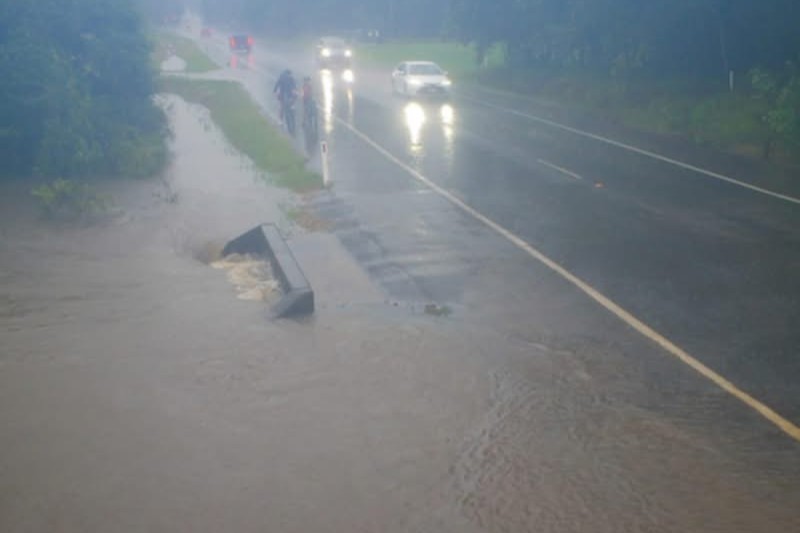
A woman has been rescued from floodwaters as heavy rain continues to soak the Sunshine Coast.
A Queensland Fire Department spokesperson said the woman was trapped on top of her car in floodwaters on Bald Knob Road, Peachester, last night.
Swiftwater rescue crews were called to London Creek about 10.20pm, and the woman was taken to safety by a rescue craft by about 11.45pm.
The Queensland Ambulance Service reported the woman was uninjured and did not require hospitalisation.
A Severe Weather Warning for heavy, locally intense rainfall was issued early this morning by the Bureau of Meteorology (BOM) covering the South-East Coast forecast district, including parts of the Sunshine Coast.
“Heavy rainfall which may lead to flash flooding is likely over southeastern districts,” it states in the warning for the south-east.
“Six-hourly rainfall totals between 70mm and 120mm are likely, with isolated totals around 180mm possible. Twenty-four-hourly rainfall totals between 80mm and 140mm are likely, with isolated totals around 250 mm possible.”
Conditions are expected to ease during early Tuesday morning, the BOM said.
A Flood Watch for most of Queensland has also been issued, which includes Sunshine Coast rivers and creeks.
A minor flood warning was issued for the Maroochy and Noosa rivers last night, with the BOM saying flooding was possible at Tewantin and Palmview this morning on high tides.
“Moderate to heavy rainfall is forecast for Monday over the Maroochy and Noosa river catchments, which is likely to cause river level rises and minor flooding across the catchment,” it says.
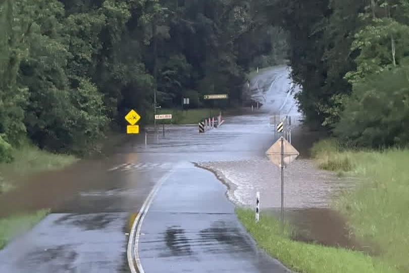
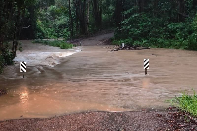
More than a dozen roads around the region are closed due to flooding. Among them are Yandina-Coolum Road and Vee Road, Yandina; Eudlo Flats Road, Forest Glen; Old Gympie Road, Glenview; Wappa Dam Road, Kiamba; and Image Flat Road, Kureelpa.
Data from 9am Sunday to 8am Monday shows the highest falls were recorded at Crohamhurst with 150mm, followed by Yandina Creek with 146mm.
Other significant totals included Eumundi and Poona Dam at Image Flat with 143mm, while Diddillibah and Maroochydore each recorded 142mm. Doonan Creek and Radar Hill at Parklands both received 141mm, while Coolum West recorded 140mm.
Nambour received 124mm, while Beerwah recorded 111mm, Sugarbag Road at Caloundra 106mm and Tewantin 104mm during the same period.
Damage due to flooding also caused an unplanned power outage affecting 43 customers at North Arm, Verrierdale and Yandina Creek.
Bureau of Meteorology meteorologist Helen Reid told Sunshine Coast News a combination of weather systems had combined to create the downpours.
“(Tropical low) 29U, which was working its way down the coastline last week, crossed the coastline and interacted with a trough that’s come through from the south,” she said.
“It’s all lined up with what’s happening in the upper atmosphere and created the opportunity for so much water to come down in the last 24 hours.”
Ms Reid said the Sunshine Coast, northern Brisbane, parts of the Central Highlands and Coalfields, and Wide Bay and Burnett received significant rainfall totals, with about 200mm in areas of the South Burnett.
She said the high rainfall figures were relatively common in March.
“You can get some pretty high numbers at this time of year – it is the wet season,” she said.
Ms Reid said some parts of the Sunshine Coast could receive heavy rain on Monday, before conditions likely ease on Tuesday.
“We’re expecting Monday to continue to be quite wet,” she said.
“A couple of places might even collect 100mm again during the day.
“Then, suddenly it will feel like it will stop, tomorrow, when we’re only looking at a couple of showers. It will just be a shower or two wandering through, maybe 5 to 10mm.
“We’ll probably be able to breathe a sigh of relief and start mopping up.”
She said there could be just a few showers during the rest of the week, with the potential for more rain on the weekend.
“That system will move away to the east and give us a nice break (but) on Saturday we might get a bit more.”
