
Noosa Council has moved to secure the long-term safety of a landslip-affected area in Sunrise Beach.
The decision came during the Ordinary Meeting on February 19, when councillors voted unanimously to award Sunshine Civil Solutions Pty Ltd the contract, valued at $2,492,858.96.
As part of the Sunshine Creek Landslide Stabilisation Project, the contract allows the council’s chief executive officer to negotiate and execute the agreement, with authority to adjust the contract by up to 17.57 per cent of the project budget if required.
The stabilisation project targets slope damage near Ross Crescent in Sunrise Beach. Although temporary repairs were previously carried out, ongoing monitoring by experts highlighted the need for a more substantial fix to ensure the area’s stability.
Works are scheduled to begin in early March, and include: removal of existing materials from the site; stabilisation of the embankment to protect the footpath and surrounding infrastructure, including stormwater systems and utilities; and removal of non-compliant beach accesses, while Beach Access 35 will remain unchanged.
Want more free local news? Follow Sunshine Coast News on Facebook, LinkedIn and Instagram, and sign up for our FREE daily news email.
Steep slopes and nearby utilities mean construction access will be limited, resulting in changes to traffic and pedestrian movements.
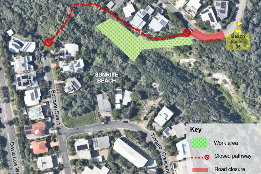
Residents and visitors can expect: a road closure near the pathway entrance; closure of the pathway between Sobraon Street and Adams Street/Ross Crescent; reduced speed limits and active traffic control in the area; and short-term, intermittent closures of Beach Access 35 for public safety.
Construction is expected to be completed by June 30, which is dependent on weather and site conditions.
Standard working hours will be 6am to 6pm, Monday to Friday, with occasional Saturday work.
Council has urged parents to plan safe alternative routes for children who use the pathway and promised further updates once the contractor finalises construction details.
The aerial imagery in this story is from Australian location intelligence company Nearmap. The company provides government organisations, architectural, construction and engineering firms, and other companies, with easy, instant access to high-resolution aerial imagery, city-scale 3D content, artificial intelligence data sets, and geospatial tools to assist with urban planning, monitoring and development projects in Australia, New Zealand and North America.
