
A coastal geography expert says Bribie Island could be subjected to another tidal breakthrough, although it’s “hard to tell” if it would be permanent.
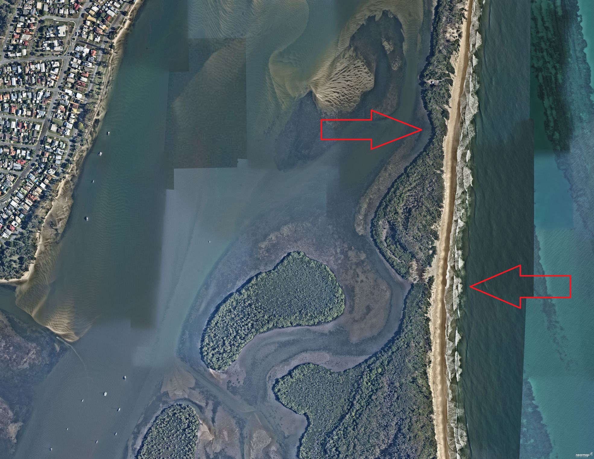
University of the Sunshine Coast Associate Professor Javier Leon says overwashing has been occurring at a slender section of the isle, about 1400m south of the large tidal breakthrough that divided the island two years ago.
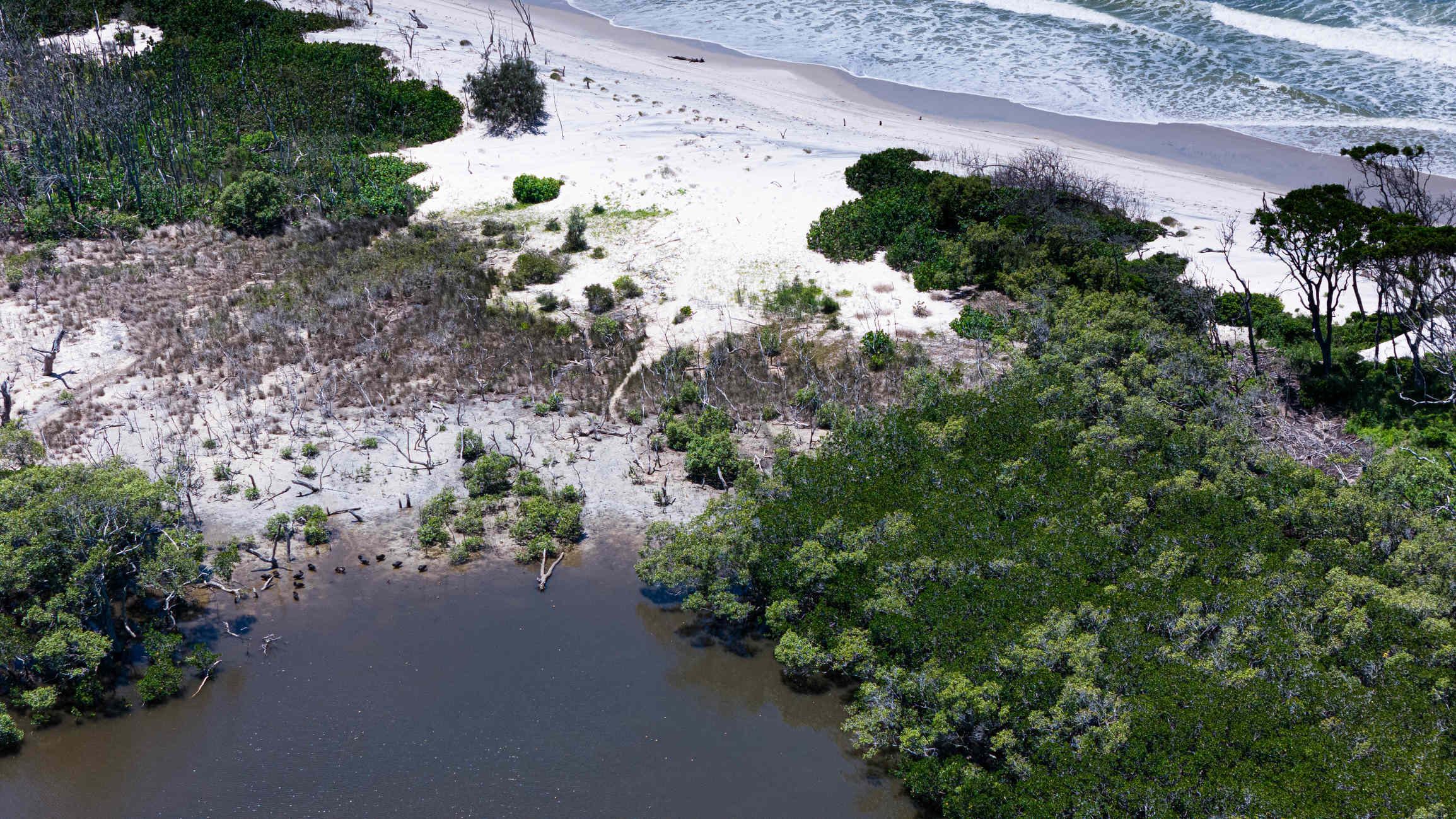
Photographer/videographer Damien Lange captured images of the site last week, showing where the water had flowed over the island.
He spotted it while scouting another narrow area.
“I put the drone up two weeks ago and was looking at that section, and I could see that it wouldn’t take much for it to break,” he said.
Do you have an opinion to share? Submit a Letter to the Editor at Sunshine Coast News via news@sunshinecoastnews.com.au. You must include your name and suburb.
“We’ve since had cyclones and high tides, so I put the drone up again and I came across this other section.
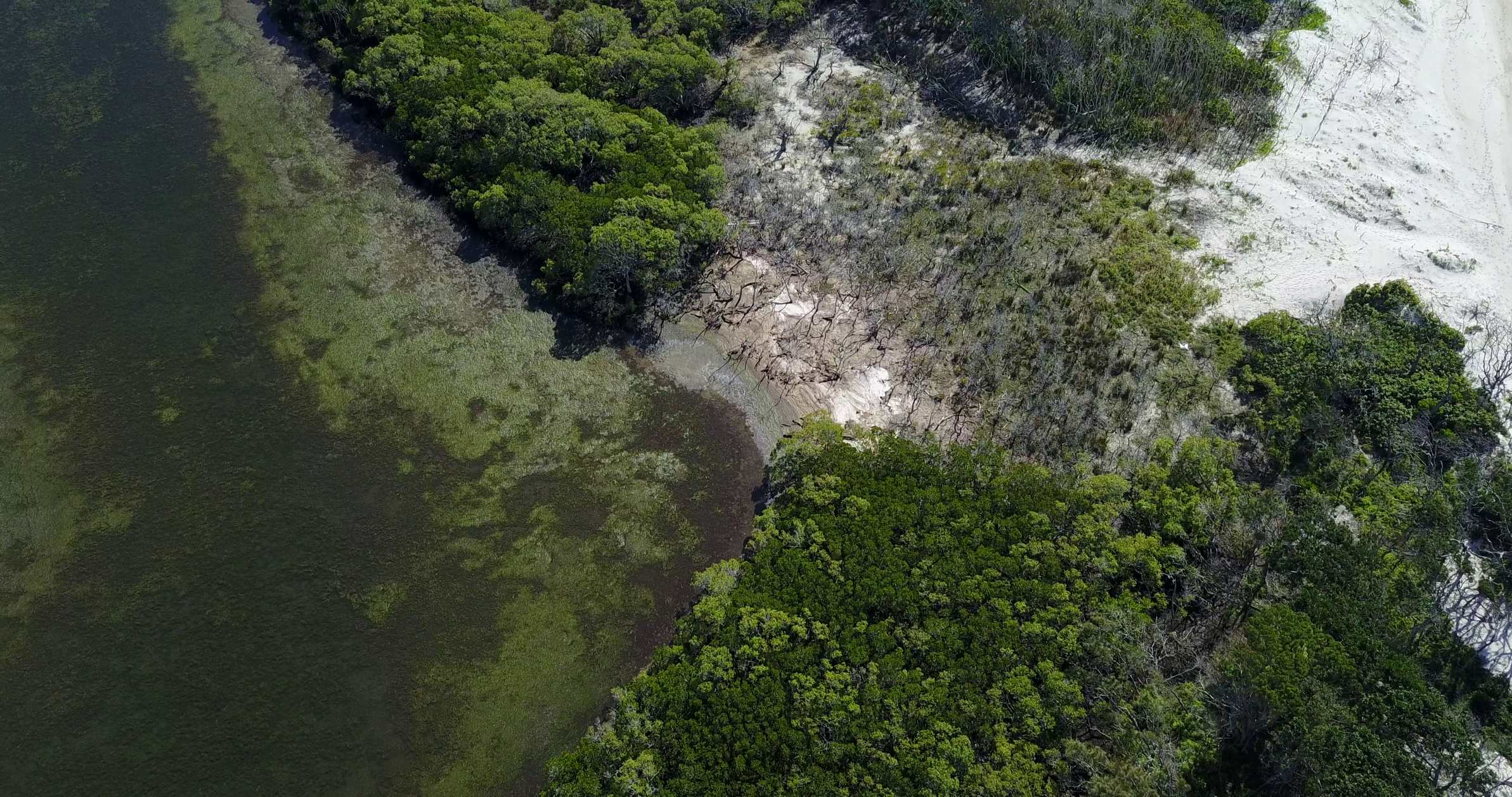
“You can see the water has flowed right across and the salt has killed the vegetation.”
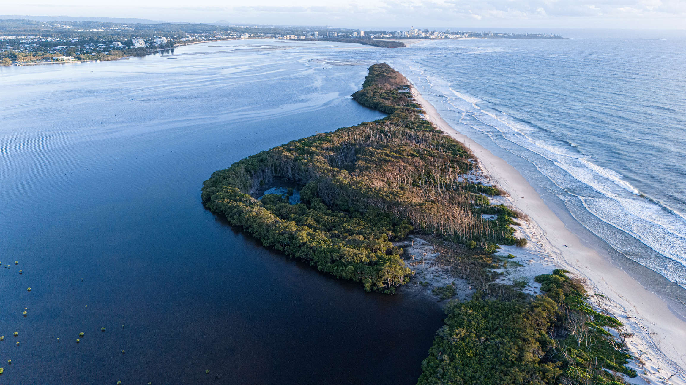
Dr Leon said ocean water has flowed over that part of the island on multiple occasions.
“There has been overwashing on that site during high-water-level events like high tides and big-wave events for a few years now,” he said.
“I expect this process to keep happening in the near future whenever a combination of high tides and/or large waves occur. Sand will erode from the beach side and be transported to the lagoon side.”
He said a breakthrough could occur there, but it may not be like the more permanent one to the north.
“A new temporary breakthrough can be possible if the beach erosion rates are higher than the deposition rates – for example, if waves from a cyclone or large low-pressure system coincide with a high tide,” he said.
“The site is quite unstable already as vegetation cover has been impacted.”
“(But) it is harder to tell if a new potential breakthrough will be permanent or not.”
He said a breakthrough or more severe weather events could significantly affect the surrounds.
“Mangroves and submerged ecosystems can be potentially impacted by more energetic conditions and by more sediment moved towards the lagoon,” he said.
Caloundra Coast Guard inspected the area during the weekend. Delta Crew member Tony Di Battista confirmed vegetation had been washed away just north of Lions Park.
“There was no evidence of a cut-through but at high tides, water is likely to reach parts of that area. The east side of that section is steep due to erosion,” he said.
“We will monitor periodically.”
A king tide of 2.1m is expected on Saturday.
The initial tidal breakthrough at Bribie Island happened in January 2022, when a king tide of about 2.2m combined with heavy swells associated with ex-Tropical Cyclone Seth to crash through the northern tip of the island.
It is now about 1.2km wide, is known as the Bribie Bar and is the primary link for boaties to go between the Pumicestone Passage and the ocean.
The breakthrough caused immense change in the area, with sand shifting through the passage and essentially blocking the nearby Caloundra Bar.
Council has been monitoring erosion while the Department of Environment and Science has been conducting water quality tests.
A DES spokesperson said coastal scientists from the DES and Innovation continued to observe the environmental changes at the northern end of the Pumicestone Passage.
They believed a new breakthrough was “unlikely” at the site where Mr Lange took the photos.
“The island immediately south of the entrance continues to erode and is subject to wave over-wash, with sand bars accumulating in behind,” they said.
“The area shown in the photos (taken by Mr Lange) has experienced wave over-wash of the dunes several times since 2008, which moves the dune sand further west where it is trapped and builds up the land.
“The formation of a new tidal channel here is considered unlikely due to the shallow waterway in behind and the over-wash sand being trapped locally.”
But the spokesperson added that DES officials were uncertain about the region’s future.
“These are natural coastal processes that change over time, and as such it is difficult to predict what further changes will occur on Bribie Island,” they said.
“Members of the public are reminded that the breakthrough areas and moving sand formations remain part of the Bribie Island Recreation Area and visitors should be mindful of the regulations in the area with respect to dogs, fires and camping, and should check Park Alerts for the latest information.”
The aerial imagery in this story is from Australian location intelligence company Nearmap. The company provides government organisations, architectural, construction and engineering firms, and other companies, with easy, instant access to high-resolution aerial imagery, city-scale 3D content, artificial intelligence data sets, and geospatial tools to assist with urban planning, monitoring and development projects in Australia, New Zealand and North America.
Subscribe to our FREE daily news feed. All it requires is your name and email at the bottom of this article.
