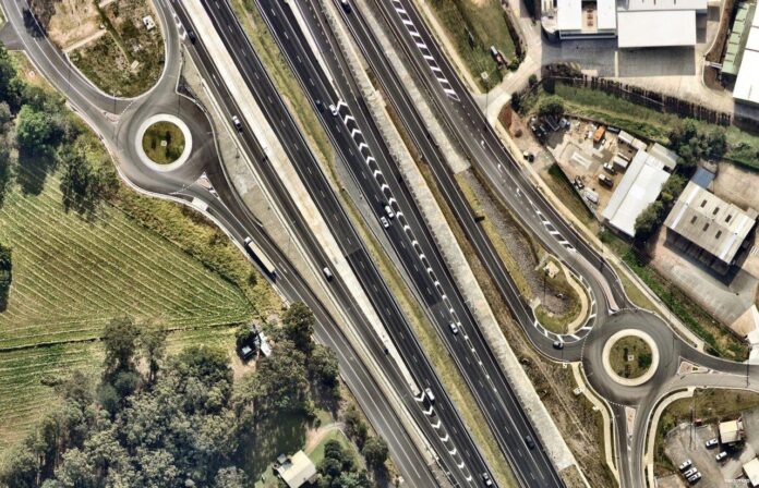
It’s a daily bugbear for many Coast residents, sitting in traffic congestion on one of our busy roads.
And the pressure on our road network is only set to increase, with a predicted population explosion from about 365,000 locals now to more than 500,000 residents by 2041.
Related story: Expert weighs in on region’s transport future
But the Coast has seen some major road projects over the past few years, from mega-million-dollar upgrades to the Bruce Highway, to smaller improvements to increase vehicle movement in traffic hotspots.
To show how our roads have changed over the years, Sunshine Coast News has partnered with Australian location intelligence company Nearmap to bring readers a series of interactive photos. Simply drag the slider across the photos to compare different years.
Cooroy Noosa Road and Beckmans Road, Tewantin: October 2020 to July 2023
Related story: Accident hotspot finally gets safety upgrade
Evans Street and Millwell Road, Maroochydore: September 2014 to July 2023
Bruce Highway, Pomona: January 2010 to July 2023
Bruce Highway and Sunshine Motorway, Tanawha/Sippy Downs: September 2016 to July 2023
Related story: Biggest road project in history opens to motorists
Eumundi Noosa Road, Rene Street and Gateway Drive, Noosaville: July 2010 to July 2023
Bruce Highway, Nambour Connection Road and Maroochydore Road, Woombye/Forest Glen: September 2016 to July 2023
Related story: The new traffic changes as $301m upgrade takes shape
Related story: Shifting sands: photos show how coastline has changed
Bruce Highway, Leafy Lane and Sandalwood Lane, Forest Glen: September 2016 to July 2023
Related story: Local traffic about to ease for two major roads
Kawana Way, Station Road and Lake Kawana Boulevard, Birtinya: January 2010 to July 2023
Bells Creek Road and Bells Creek Arterial Road, Caloundra South/Bells Creek: December 2017 to July 2023
Related story: ‘Congestion buster’: $70m connection to highway opens
Queen Street and Bower Street, Caloundra: November 2021 to July 2023
Related story: Road upgrades outside busy school completed
Kawana Way, Creekside Boulevard and Caloundra Mooloolaba Road, Meridan Plains: November 2013 to July 2023
Brisbane Road, Mooloolaba: July 2010 to July 2023
Related story: Four new lanes: upgrades continue on major road
Related story: Interactive aerial imagery shows how Coast has changed
Bruce Highway, Caloundra Road and Steve Irwin Way, Glenview: September 2016 to July 2023
Related story: Biggest road project in history opens to motorists
Sunshine Motorway, Peregian Springs: September 2016 to July 2023
Maroochydore Boulevard and Dalton Drive, Maroochydore: January 2010 to July 2023
Related story: Upgrade for intersection used by 35,000 cars each day
The aerial imagery in this story is from Australian location intelligence company Nearmap. The company provides government organisations, architectural, construction and engineering firms, and other companies, with easy, instant access to high-resolution aerial imagery, city-scale 3D content, artificial intelligence data sets, and geospatial tools to assist with urban planning, monitoring and development projects in Australia, New Zealand and North America.
Want more free local news? Follow Sunshine Coast News on Facebook, LinkedIn and Instagram, and subscribe for our FREE news feed, direct to your inbox daily.


