
Traffic concerns at a Sunshine Coast primary school have prompted the state government to act.
Transport and Main Roads staff identified “several safety issues”, including parents parking within a bus zone, during a visit to Glenview State School in mid-March, prompting the formation of a Safe School Travel Committee.
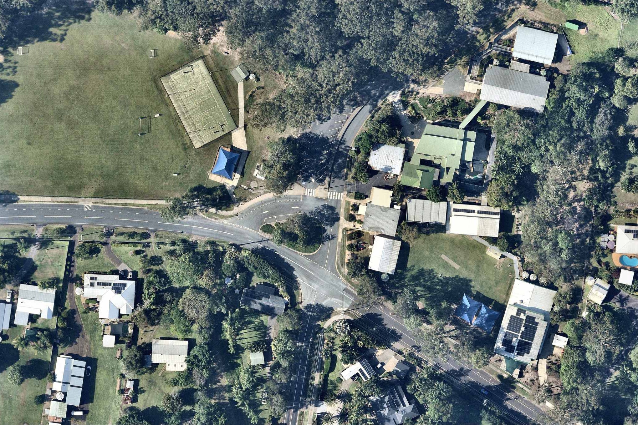
The bus zone was installed in 2020, replacing a drop-off and pick-up area that was relocated further down the road.
Parent Kristy Nottidge said that the change led to traffic woes.
“The resulting chaos in the afternoons is something to behold,” she said.
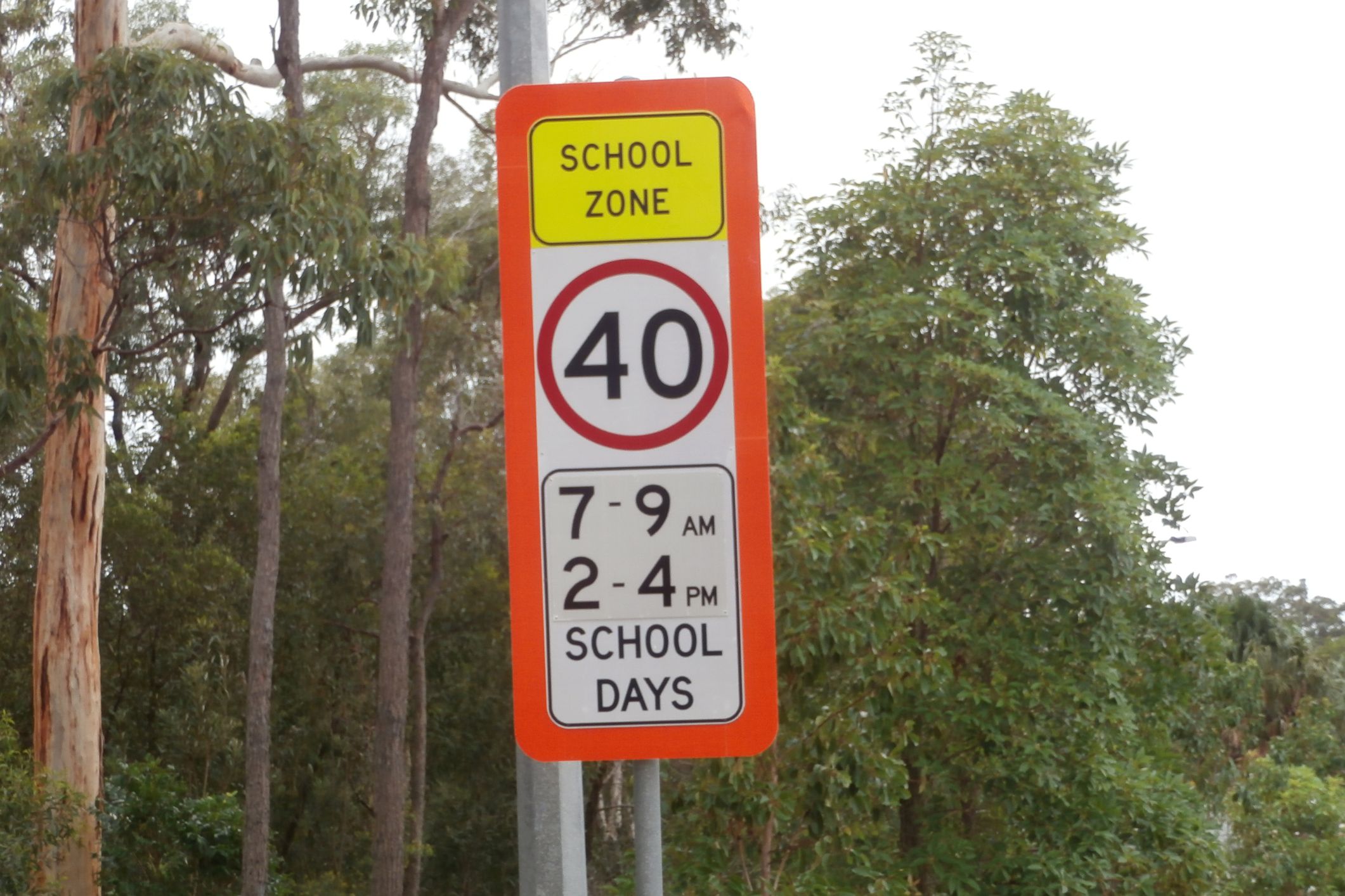
“There is queued traffic down Glenview Road … cars queued to the crest of the hill near Rosemary Avenue and beyond the school speed zone, so the 70km/h traffic coming along is met with a traffic jam over a blind crest. How no serious accidents have occurred is just pure dumb luck.”
She stated that, as a result of congestion, “limited parking” and “few buses”, parents continued to use the old two-minute zone, which she said came to a head recently.
Ms Nottidge claims that TMR staff “reprimanded” crossing supervisors for not telling parents to move on from the area.
“It’s impossible for crossing staff to monitor kids going across the road and an entire bus zone at the same time,” she said.
“It was enough of a concern to parents that they took photos of the TMR staff doing this.”
But a Transport and Main Roads spokesperson said crossing supervisors were not told to move drivers on.
“School crossing supervisors have not been directed to move drivers from the bus zone as this is not part of their core duties, which is ensuring school children cross the road safely.”
As per TMR’s school crossing supervisor guidelines, supervisors are not permitted to approach offending vehicles or parents.
Ms Nottidge also said the bus zone was a “terrible area for buses”.
“It’s extremely steep and on a curve. My son was on an excursion bus that was wedged on the road for some time. Scrape marks are visible on the road from when buses have been wedged.”
The bus zone is now on the north-western side of Leeding Road. It used to be a two-minute parking zone; buses excepted.
The 70m Stop, Drop and Go zone, which is 70m long, is now on the northern side of Glenview Road, adjacent to the school oval. It’s about 40m from the bus zone and 60m from the main school entrance.
A Sunshine Coast Council spokesperson said that the council constructed the Stop, Drop and Go area six years ago, to “support parents during school drop-off and pick-up times”.
Help us deliver more by registering for our FREE daily news feed. All it requires is your email at the bottom of this article.
They confirmed TMR staff recently attended the school and noted several safety matters, prompting the state government to form an action group.
“(TMR) representatives visited GSS last week and identified several safety issues, including parents parking within the designated bus zone,” they said.
“In response, TMR is establishing a Safe School Travel Committee to work collaboratively on the concerns raised.
“As this is an inter-agency initiative, representatives from all relevant agencies, including Council, have been invited to participate.
“Council will continue to work with partner agencies to support ongoing safety initiatives and assist in educating motorists.”
The spokesperson said that the safety of all road users, particularly children, was a priority.
Ms Nottidge said parents contacted the council, and the offices of local councillor Winston Johnston and Caloundra MP Kendall Hatcher. She said she had also reached out to the Minister for Transport Brent Mickelberg and TMR.
She said parents and surrounding residents would “like a solution to the chaotic parking and traffic situation”.
The aerial imagery in this story is from Australian location intelligence company Nearmap. The company provides government organisations, architectural, construction and engineering firms, and other companies, with easy, instant access to high-resolution aerial imagery, city-scale 3D content, artificial intelligence data sets, and geospatial tools to assist with urban planning, monitoring and development projects in Australia, New Zealand and North America.
