
Sunshine Coast Council is undertaking a safety review of a key road through a local town.
Officials are set to assess Lindsay Road, which is used by about 3500 vehicles per day, in Buderim.
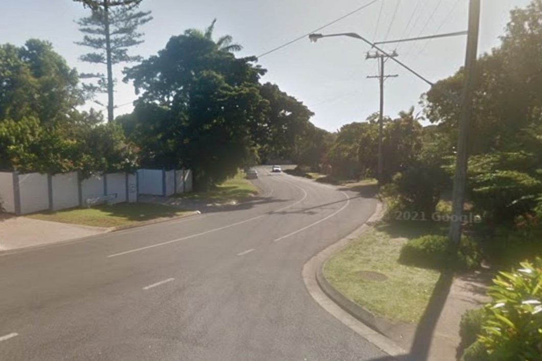
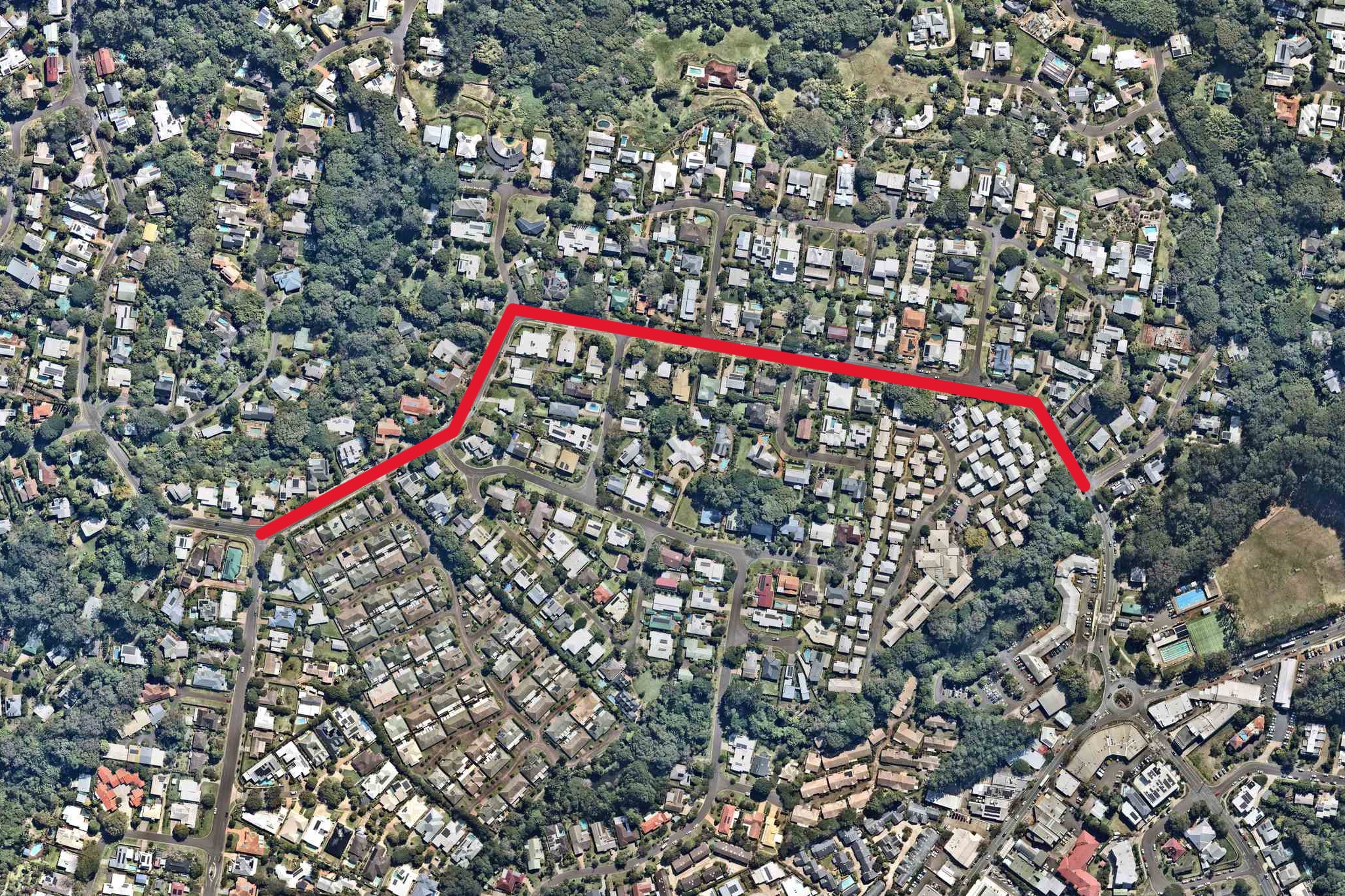
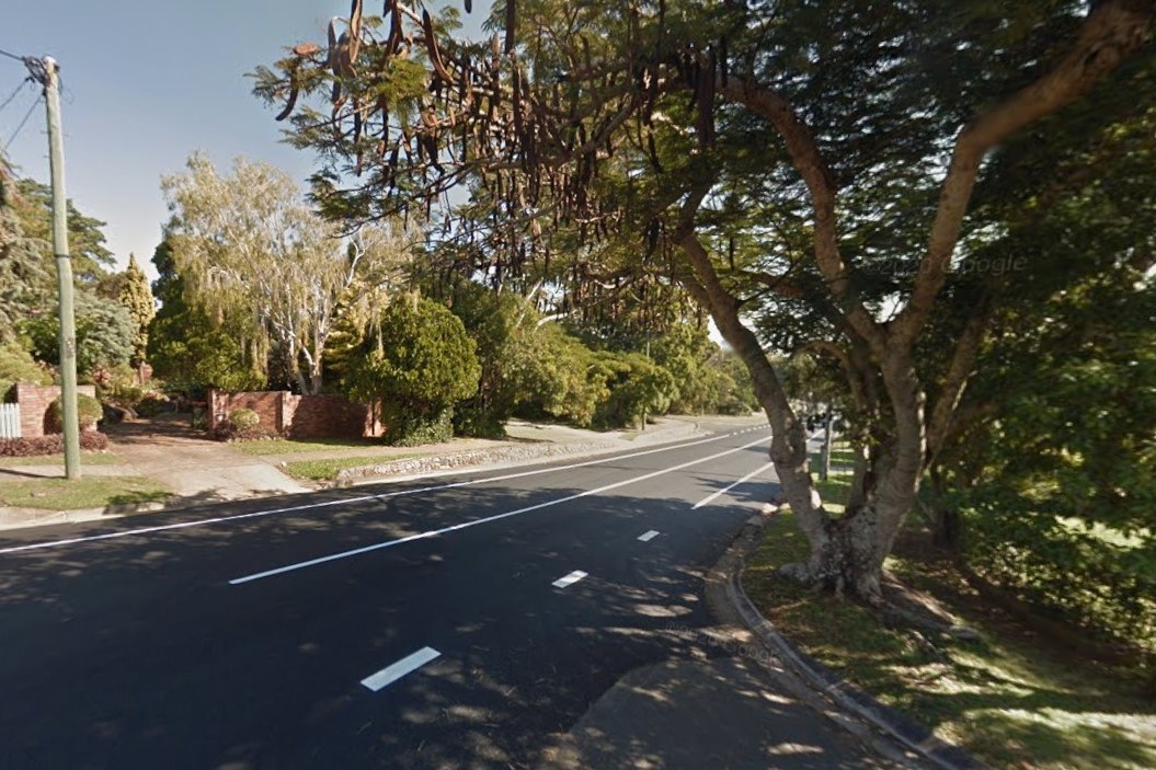
The announcement of the review comes after concerned locals started a petition on change.org calling for improved safety measures along an 850m stretch of the road from Tulip Lane to Quorn Close.
More than 40 people signed the petition, which is titled ‘Lindsay (the forgotten residential) road — it’s time to consider the residents’.
It stated that the stretch of road is “dressed” as a 60km/h transit road but that it’s “true primary function” is a residential street.
Want more free local news? Follow Sunshine Coast News on Facebook, LinkedIn and Instagram, and sign up for our FREE daily news email.
“Despite being a busy pedestrian and cyclist route, this section of Lindsay Road’s need for safety improvements has been ignored, while other entrances to Buderim Village are now 50km/h despite many having fewer homes, better sight lines, wider parking lanes and footpaths on both sides,” it stated.
The petition stated that it includes winding curves, blind corners and a crest, plus a well-known sharp corner with no designated crossings.
“Almost 400 residences are within this stretch, with a further 280-plus down side streets,” it stated.
“It’s clear most of the traffic is local, not simply a thoroughfare.
“The road conditions, prevalence of speeding and lack of warning signs to alert drivers of local residents crossing the road to access the footpath or bus stops, make it very dangerous.
“The current road conditions on this section present significant safety concerns for residents, pedestrians and vulnerable road users.”
The petition called on the council to recognise the section as a residential road and to provide pedestrian crossings, adequate signage, line marking, traffic calming measures and an improved footpath along the northern side of the road. It also called for a reduced speed limit, to bring it into line with other main roads in Buderim.
A council spokesperson said a study of the road will influence possible works, and acknowledged the area was busier.
“This review will assess traffic volumes, speed data, crash history and roadside risks and will inform a formal speed limit review,” they said.
“While pedestrian numbers are currently unknown, traffic volumes are gradually increasing, consistent with regional trends.”
The spokesperson said the speed limit will be looked at.
“Speed limits are determined through a formal review process that considers factors such as traffic volumes, road alignment, crash history, roadside hazards and prevailing vehicle speeds,” they said.
The section between Tulip Lane and Quorn Close is a two-way undivided road with on-street parking, multiple intersections and numerous property accesses.
Council data shows that two crashes have been recorded in the area: one involving a motorbike at the Ryhope Street intersection that resulted in hospitalisation and one involving a vehicle colliding with a parked car that led to medical treatment, during the past five years.
Authorities have implemented some measures to improve safety.
“Council has installed vehicle activated signs and warning signage along Lindsay Road in recent years to improve driver awareness,” the spokesperson said.
There is also a petition regarding Tulip Lane.
More than 100 residents have urged the local council to install safety measures along the road that runs through the middle of a neighbourhood.
The aerial imagery in this story is from Australian location intelligence company Nearmap. The company provides government organisations, architectural, construction and engineering firms, and other companies, with easy, instant access to high-resolution aerial imagery, city-scale 3D content, artificial intelligence data sets, and geospatial tools to assist with urban planning, monitoring and development projects in Australia, New Zealand and North America.
