
A key new link in the Sunshine Coast’s Coastal Pathway network is set to improve connectivity for pedestrians and cyclists in a beachside suburb.
The new path at Golden Beach will connect the recently completed Bells Esplanade path at Jensen Park with the existing path at Keith Hill Park.
The stretch will include a raised pedestrian crossing over the Bells Creek boat ramp access driveway.
Construction is planned to start in November, subject to tender processes.
A Sunshine Coast Council spokesperson said the 150m, 3m-wide path would provide an important link between key recreational areas.
“(It) follows a popular route already used by pedestrians and will formalise a safer, more accessible connection for the community,” they said.
Want more free local news? Follow Sunshine Coast News on Facebook, LinkedIn and Instagram, and sign up for our FREE daily news email.
The project is jointly funded by the council and state government.
Council has contributed $123,500, matched by $123,500 from the Department of Transport and Main Roads through the Cycle Network Local Government Grant.
Jensen Park and Keith Hill Park are popular parks for Golden Beach and Pelican Waters residents, as well as visitors.
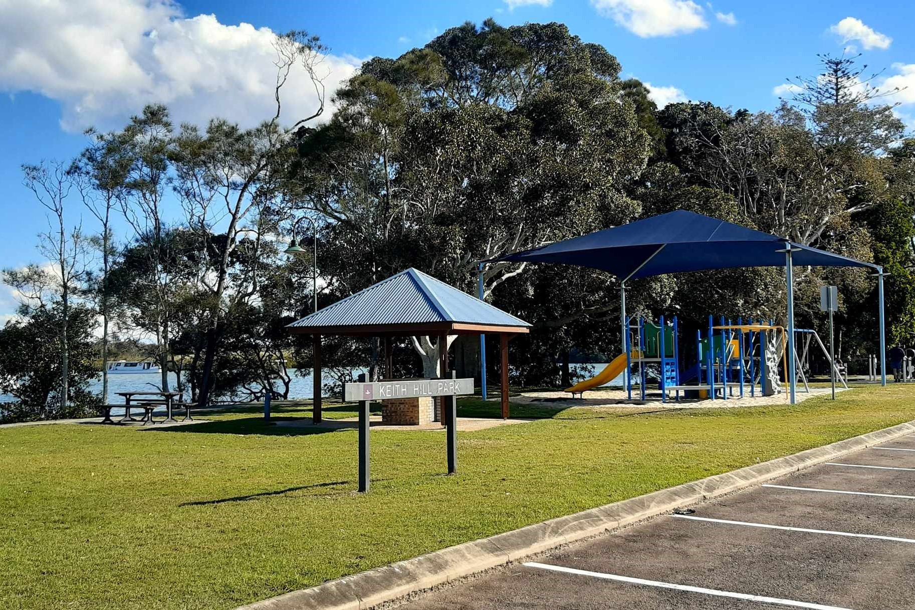
The former includes playgrounds, picnic areas, disc golf, open spaces, public amenities and off-street parking, while the latter stretches for 1.5km and offers barbecue and picnic facilities.
The boat ramp, situated between the parks, is a sometimes busy access point to Bells Creek, the Pumicestone Passage and the open ocean for fishers and recreational boaters.
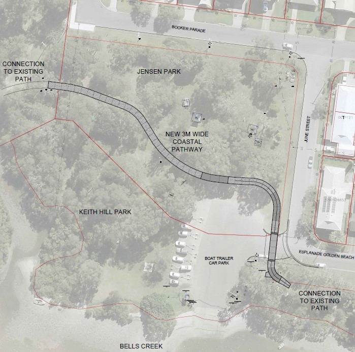
The planned pedestrian crossing near the boat ramp access is expected to ensure pedestrians and cyclists can safely move between the two parks.
The spokesperson said the new path would fill a key gap in the region’s most significant active transport corridor.
“This new pathway section will form part of the broader Coastal Pathway network, which continues to provide valuable recreational and transport opportunities for residents and visitors alike,” they said.
“The pathway connection will significantly improve access and safety for users.”
Parts of Golden Beach have been battered by the elements in recent years, but the spokesperson said the path would be well protected.
“The pathway alignment is located away from the water’s edge,” they said.
Long-term local Gail Podbersek said she was a fan of the plan.
“I reckon it’s an excellent plan to take walkers along all of Caloundra’s coastal beaches,” she told Sunshine Coast News. “I love it. I expect the community will be delighted to see this (new plan) in place.”
She explained the current layout.
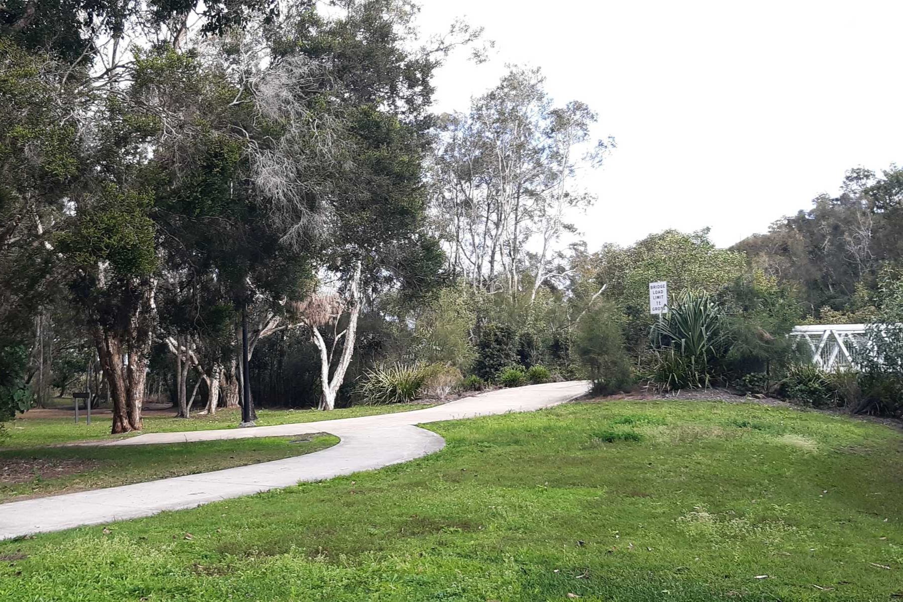
“Entering from the Pelican Waters bridge, the concrete pathway stops abruptly about 3m into (the eastern side of) Jensen Park,” she said.
“The dirt track has evolved through use and extends to the bitumen area, which is used as a parking and launch site at the Bells Creek boat ramp and links with the existing Coastal Pathway on the other side, leading into Keith Hill Park.”
She also described the two parks.
“Jensen Park is now only a scrap of the vegetation once in this broad area, which became Pelican Waters,” she said. “What’s left of the actual park has magnificent mature trees, decades old.
“It’s a beautiful place, with picnic and barbecue facilities and plenty of seating for walkers who like to take a break and appreciate the magnificent views, peace and serenity of the Bells Creek Esplanade.
“There are facilities in Keith Hill Park for exercise, play for kids and family barbecues. Council commissioned a wildlife artist to decorate the toilet block with images of the incredible migratory birds who fly 13,000km to visit every year.
“Unfortunately, the impact of the (Bribie Island tidal) breakthrough/coastal erosion is huge here but that is another story, one which I hope will have a happy ending as result of containment works and restoration of the foreshore parks to the east.”
Ms Podbersek also said more could be done for active transport in the area.
“We have been awaiting pathways in Diamond Head for some time and have been pleased to see several sections installed on Anning Avenue in the fairly recent past, linking from Michael Street north,” she said.
“(But) the community seems more generally concerned by the lack of a safe crossing on Anning Avenue, from Michael Street to the bridge across Lamerough Canal.
“Commonly, groups of littlies from the kindy and elders on walkers from St Mary’s Aged Care wait for a gap in what is a 60km/h zone to cross to our foreshore parks.”
Other locals expressed their opinions about the proposed pathway and Jensen Park, via social media.
“Hopefully, no trees to be removed,” Michael Yeates said.
“The park is a disgrace, full of weeds and little attention,” Donna Kerr Upton said.
The aerial imagery in this story is from Australian location intelligence company Nearmap. The company provides government organisations, architectural, construction and engineering firms, and other companies, with easy, instant access to high-resolution aerial imagery, city-scale 3D content, artificial intelligence data sets, and geospatial tools to assist with urban planning, monitoring and development projects in Australia, New Zealand and North America.
