
Sunshine Coast locals have been advised to take cover as Tropical Cyclone Alfred closes in.
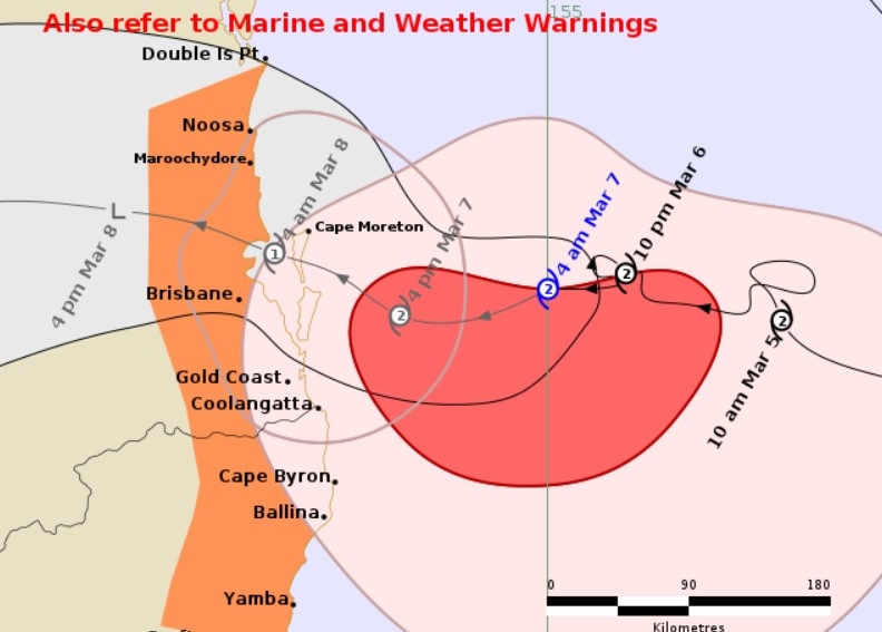
A cyclone warning was issued for Double Island Point to Grafton, early Friday, stating that the system could cross most likely close to Moreton Bay between Noosa and Coolangatta early Saturday morning, which is later than expected.
Damaging wind gusts, abnormally high tides likely to cause flooding, damaging surf and heavy rainfall have been forecast.
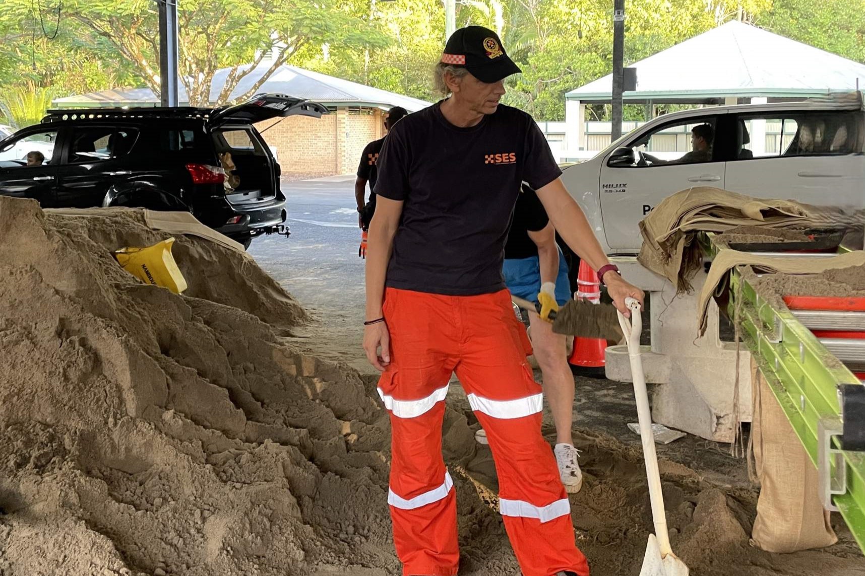
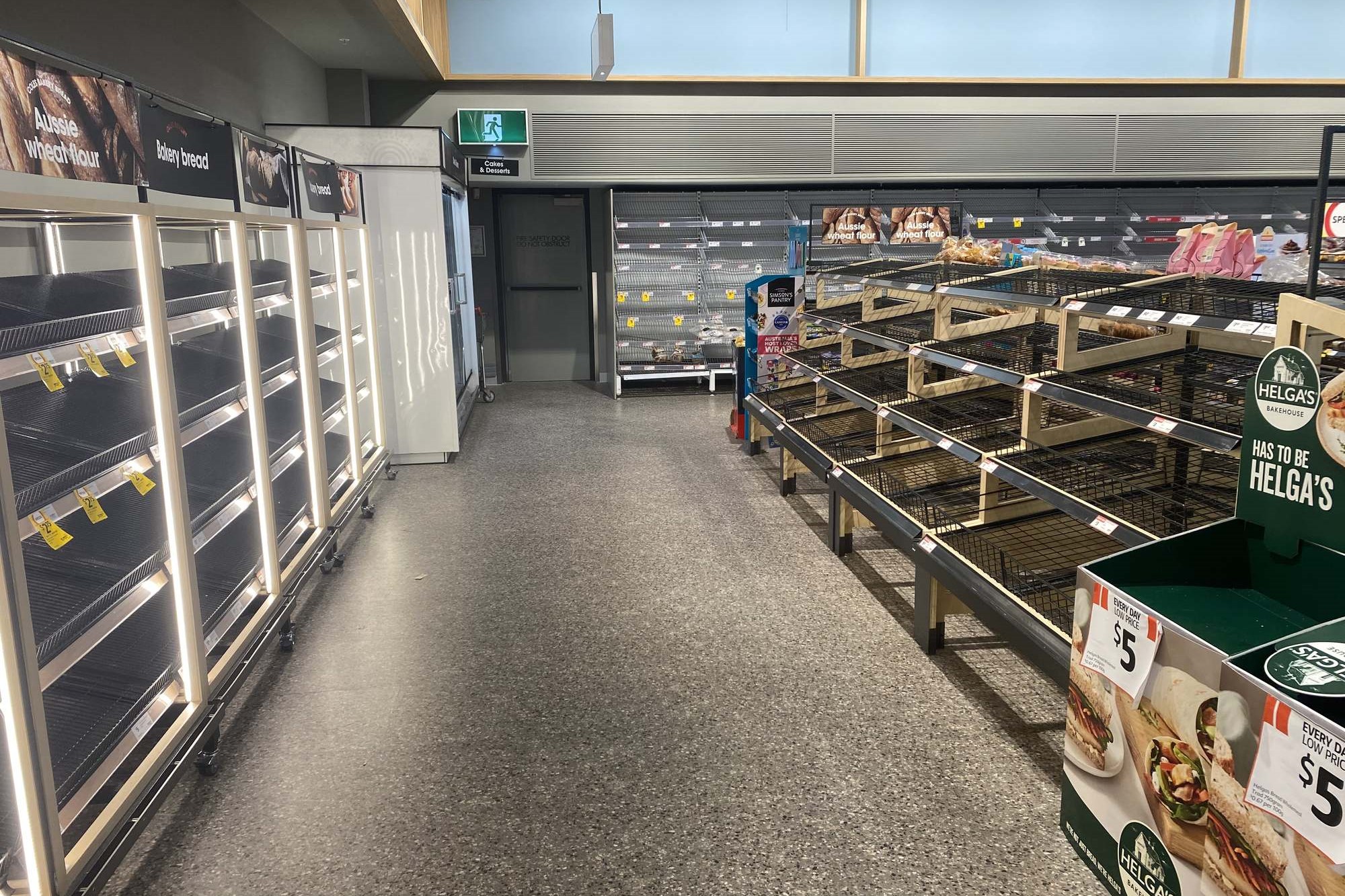
Police have door-knocked more than 1600 Sunshine Coast homes at risk of flooding, emergency refuge centres have been established, 230,000 sandbags have been collected, schools have been cancelled, beaches have been closed, public transport services have been suspended and many retailers were set to shut their doors. About 1000 homes were without power early Friday.
The strongest impacts of the cyclone should be near or to the south of the crossing point but District Superintendent Craig Hawkins said the community should be on guard.
“From this evening, I ask people to remain in their homes,” he said on Thursday.
“The storm is unpredictable. We need to continue to expect the unexpected. We could still be in the firing line.
“At this stage, we ask people to stay at home, prepare properties, be with loved ones and look after pets. If people do decide to leave, we ask them to go to friends and family or places of refuge.”
“It’s not a time for sightseeing. By sightseeing you are putting yourself at risk and impeding emergency services.”
Regardless of where the cyclone crosses, the Sunshine Coast is likely to be impacted.
Want more free local news? Follow Sunshine Coast News on Facebook, LinkedIn and Instagram, and sign up for our FREE daily news email.
Storm surge remains a serious concern for authorities, particularly if the cyclone crosses on high tide, but there are also threats of dangerous winds and flash flooding.
“Floodwater is a dangerous place,” Supt Hawkins said.
“It is not a place to play, visit or drive into.
“We strongly encourage people: do not drive into floodwater. Cars can be washed away in as little as 15cm of water.”
Supt Hawkins said he was pleased with the way locals had prepared for the Category 2 system, which could be downgraded to Category 1 just before it makes landfall.
“I’m confident we’re in a strong position for what’s coming,” he said.
“We’ve spent a lot of time and attention on storm surge and now we have to also turn our minds to wind and rain with flash flooding.
“And once the cyclone passes there will be dangers including fallen trees, astray animals, power lines down and (general) destruction.”
Emergency refuge centres have opened at the Nambour Showgrounds, Caloundra Indoor Stadium, Landsborough Sportsground and Noosa Leisure Centre. The former is open to animals as well.
Bureau of Meteorology community information officer Daniel Hayes said destructive wind gusts of 120-130km/h were possible on the Sunshine Coast as the system crosses the coast, before winds ease.
But rainfall could hang around for days.
“We could be looking at up 200-300mm,” he said. “There could be flash flooding.”
Mr Hayes said the cyclone could cross close to the high tide, of 1.7m at 3.45am on Saturday.
“But even if it doesn’t come in on the high tide, given the slow nature of the system, it (tidal surge) is still likely to be fairly significant.”
Prime Minister Anthony Albanese, who was at the National Situation Room in Canberra on Thursday, said the cyclone posed a serious threat.
“These are tough times, but Australians are tough people and we’re resilient people,” he said, before adding that money and resources were on the way to help with efforts.
“My message to people … is we are there to support you, we have your back.”
Schools have closed around the region. Schools and early childhood services are providing updates directly to families.
Sunshine Coast Health’s critical services, including emergency surgery and emergency departments, will continue to function and the local health service is working with clinicians to identify and contact vulnerable patients who may require support including transport, essential healthcare and medications.
Many local retailers have closed or plan to close. Major supermarkets Coles and Woolworths were in the process of staged closures. Coles stated that all of its Sunshine Coast stores would be closed by 4pm on Friday, while Woolworths “expected” its stores to close “early” on Friday.
Meanwhile, the Department of Transport and Main Roads urged caution.
“The combination of increased wind and rain can significantly impact safe travel because visibility will reduce,” it warned.
“TMR strongly encourages all motorists and pedestrians in South-East Queensland to drive according to conditions, reduce speeds and, as the weather worsens, avoid unnecessary travel.”
Train services have been suspended.
Sunshine Coast Airport was open on Friday morning however some airlines had cancelled services and there was the potential for more cancellations during the next 24 hours.
“All passengers are advised to continue monitoring the status of their flight and stay-up-to date with the latest information from their airline. Passengers should speak directly to their airlines,” the airport stated.
Sunshine Coast Local Disaster Management Group coordinator Bill Haddrill urged people to steer clear of dunes and seawalls, which are being impacted by erosion.
The Moffat Beach seawall has showed “signs of movement, due to the large swells”.
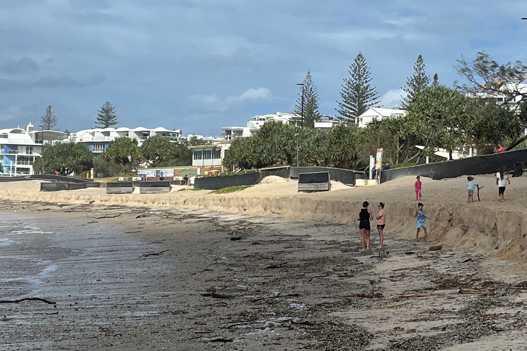
“There is a significant risk of the wall deteriorating further and if that occurs, rock falls are highly likely,” he said.
Surf Life Saving Queensland Lifesaving services manager Natalie Edwards called on people to stay away from beaches.
“Now is not the time to head to the beach for a look, especially with young children who may be pulled out by the fast-moving tides,” she said.
She said those entering the water for a surf or swim were entering at their own risk.
Call 132500 for SES assistance and 000 in life-threatening situations. For more information see getready.qld.gov.au, disaster.sunshinecoast.qld.gov.au (which includes floodmaps) and disaster.noosa.qld.gov.au.
