
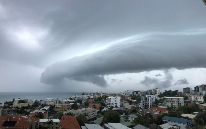
Summer is arriving and it seems the storms are too.
Pockets of the Sunshine Coast were briefly lashed with rain, lightning and thunder on Sunday, to mark the start of what could be a wild week.
A mini tornado swept through Nirimba just after 3pm, sweeping building sheets into the air, in a video captured by local resident Toni King.
“I was sitting on my bed reading … when I heard a loud bang,” Ms King explained.
“I looked out my window to see large objects flying around in circles down my street.
Watch Toni King’s video of the mini tornado here:
“I grabbed my phone to record … it was a bit scary!”
If you captured video of the storm, email it to Sunshine Coast News at: news@sunshinecopastnews.com.au
The Bureau of Meteorology said on Monday that there was the potential for hail in South-East Queensland this week while the BOM’s Danny Johnson told Sunshine Coast News on Friday that thunderstorms and anywhere up to 50mm of rain a day could impact the Sunshine Coast.
“It looks like it will be wet week,” he said.
Two weather systems have pushed across the country and one of them has drawn moisture from the tropics.
Parts of north Queensland sustained heavy falls of about 200mm in one day last week.
The Sunshine Coast is unlikely to receive the same sort of drenching, but it could get some significant rainfall totals during the week.
Do you have an opinion to share? Submit a Letter to the Editor with your name and suburb at Sunshine Coast News via: news@sunshinecoastnews.com.au
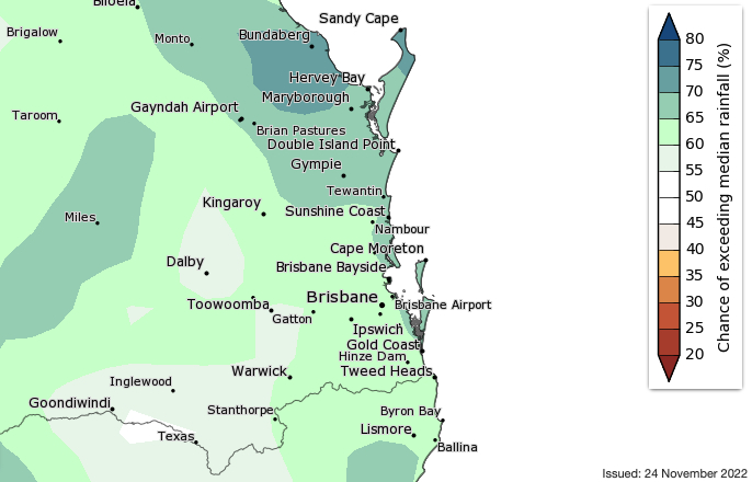
“We’re looking at (potentially) 20mm to 50mmm (per day) in some areas and with thunderstorms, that could increase,” Mr Johnson said, before suggesting each storm could dump 50mm on its own.
“Slow moving thunderstorms with local rainfall are expected to become more likely … so we could see a significant amount of rain across the week.”
And that could be a precursor for the next three months as La Nina makes its presence felt for the third straight year.
“We’re coming off the back of some crazy weather events (nationwide in 2022) but it should be back to a normal summer of La Nina, with hot, humid days and thunderstorms that roll across in the afternoons,” Mr Johnson said.
“We’re still in a La Nina phase, which increases the chance of above average rainfall (in summer).”
Renowned long-range forecaster Hayden Walker expected a wet summer.
“There should be rain and storms for many areas of South-East Queensland,” he said.
“There should be storm activity for December in particular (on the Sunshine Coast).”
Mr Walker also expected two lows to form in the Coral Sea and a cyclone to form off the north to central Queensland coast around the end of February, along with a wetter-than-usual April for the state.
Mr Walker analyses solar flares and sunspots to guide his forecasts.
“The sunspot activity has been quite prolific, which is why we’ve had a fair bit of rain in the southern states and severe storm activity, especially last year,” he said.
Temperatures should range between 19 to 31 degrees Celsius this week, with a slightly muggy but bearable dew point around 20 degrees Celsius.
SUBSCRIBE here now for our FREE news feed, direct to your inbox daily!