
Scientists are looking to the skies to explore the seas, in an ambitious new project to help future-proof the coast’s shorelines.
With a third La Nina summer almost upon us, the project comes at a volatile time for the Sunshine Coast’s shores.
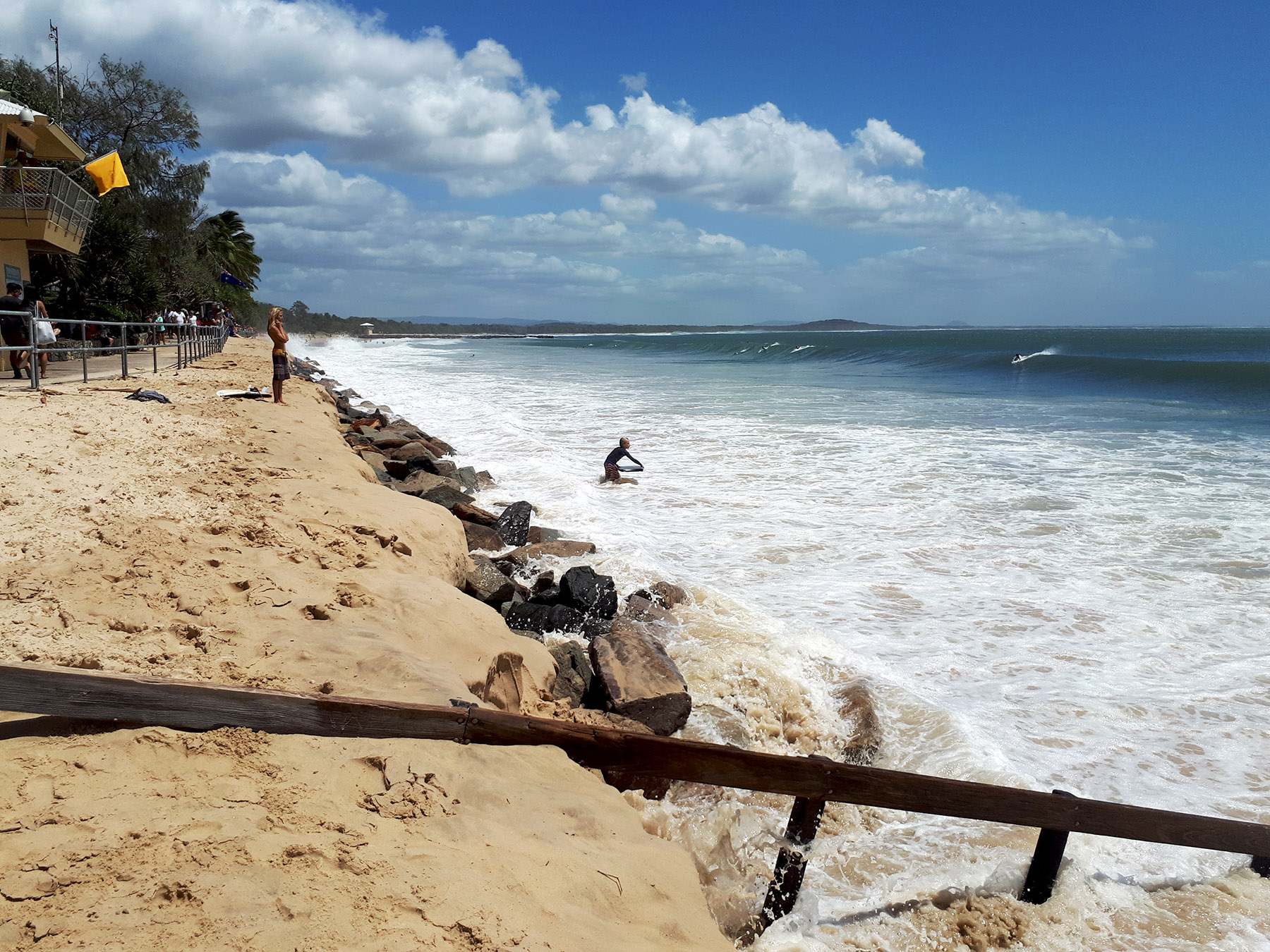
University of the Sunshine Coast lecturer in Geography Dr Javier Leon pointing out the turbulent conditions have already taken a toll on the health of the beaches.
Dr Leon said with the effects of climate change and erosion looming as ever-present threats to Queensland’s coast, the project presents a unique opportunity for almost real-time monitoring of coastal areas.
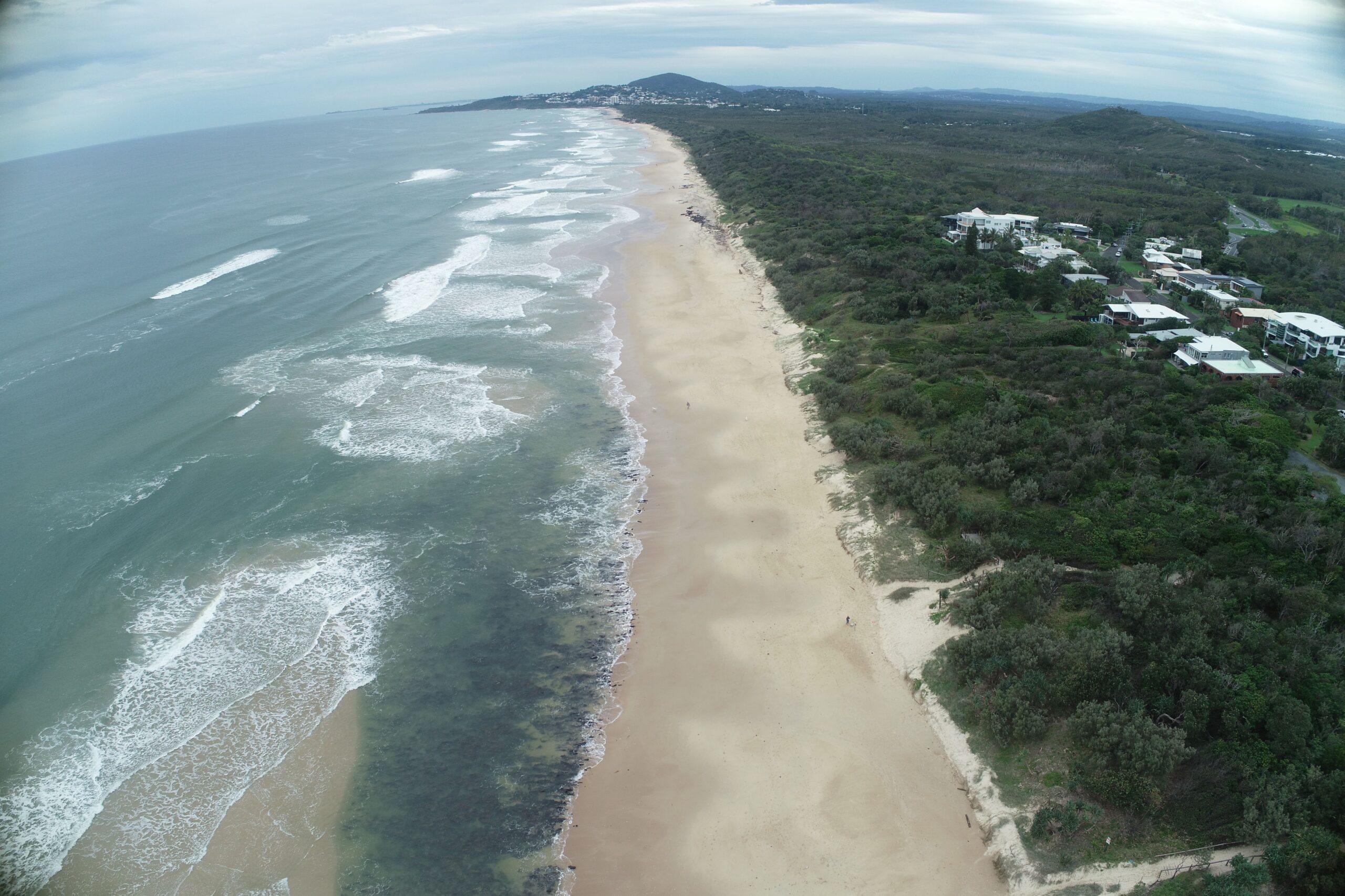
The project combines cutting-edge satellite imagery of Queensland’s Sea floor with drone surveys of its shore and dunes, to paint a comprehensive picture of the Sunshine Coast’s shifting sands.
Do you have an opinion to share? Submit a Letter to the Editor with your name and suburb at Sunshine Coast News via: news@sunshinecoastnews.com.au
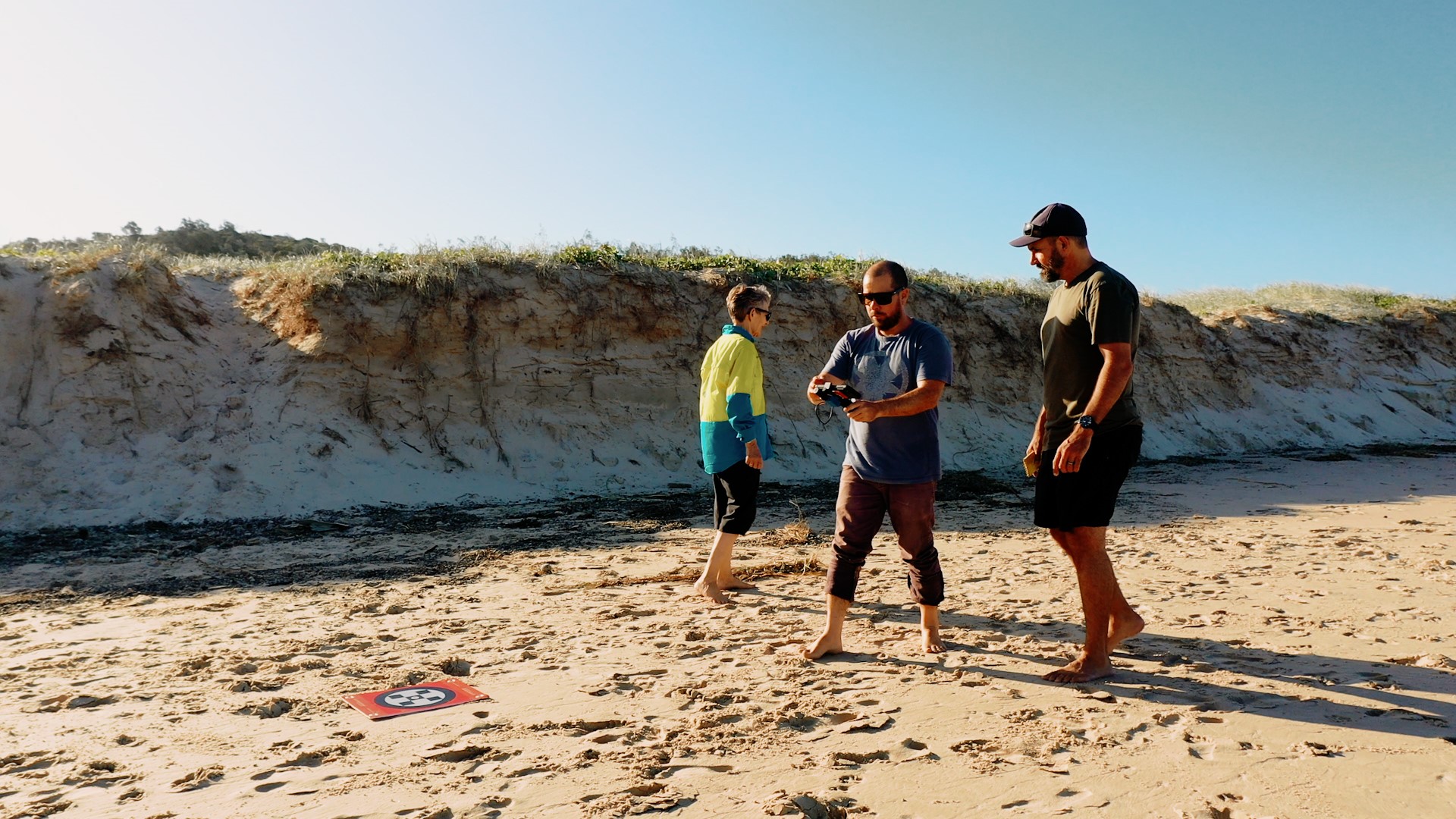
“When we merge the two, we get this kind of seamless elevation data from the dunes all the way down to the surf zone – that’s where the most sand moves,” Dr Leon said.
“We have been seeing a lot of erosion on the Noosa and Sunshine Coast coastlines … we need to keep an eye on what we have in the next few months.”
Dr Leon said there was high chances of seeing large weather events this summer, so the possibility of having a big storm coinciding with high water are much higher and would lead to more coastal erosion.
“ … we now have the chance to learn from these events,” he said.
“It will be particularly interesting to see when the sand comes back.
“Down south we have seen it take years for the sand to return, so by monitoring the movement of sand over time we will understand more and can come up with better solutions.
“There are a series of quick fixes which include sand nourishment and seawalls, but we need to be looking at long-term solutions such as managed retreat.”
Once collected, the data will be used by Dr Dan Harris from The University of Queensland for numerical modelling, to predict if and when a significant erosion event might happen.
“This data is usually non-existent, or super-expensive to get, so in previous modelling we have typically relied on older data,” Dr Leon said.
“But because the shore area changes so much – and due to this triple La Nina it’s been moving more than ever – having up-to-date data is essential.”
The data and predictive models will be made available as an online resource for Noosa Council, to help them make informed decisions on managing their shores.
SUBSCRIBE here now for our FREE news feed, direct to your inbox daily!
