
It’s going to feel more like the tropics than the Sunshine Coast in coming days – and we may be in for more wild seas.
The Bureau predicts Tuesday and Wednesday will be hot and humid, with tops of 34C and 33C respectively.
Thursday is expected to bring cooler weather and the chance of 20-40mm of rain and a top of 28C.
We are likely to see the temperature drop further into the weekend, with maximums as low as 25C and the chance of showers.
A string of lows is set to descend from the north and slide by as the week progresses and while these are likely to remain offshore, they could generate some big seas from Friday, with waves between 2m and 3m.
However, the movement of these lows is difficult to predict, even for the experts.
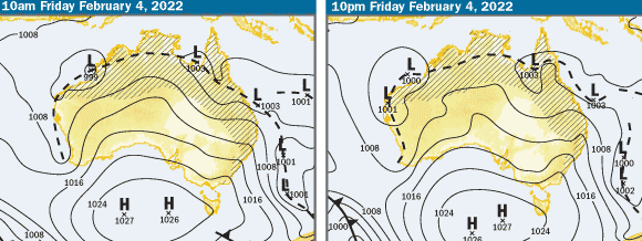
Bureau of Meteorology forecaster Helen Kirkup said there should be “reasonable swell across the south-east” but it was too early to tell how powerful it would be.
“There are a couple of lows wobbling around (in the Coral and Tasman seas) and the forecast models are doing different things with them,” she said.
“There’s certainly potential for something to come in from the east or south-east … there’s one model that shows a really deep low near Vanuatu by Friday but there’s another one that shows nothing.
“Anything could happen. The wind is going to be generally south-east but it’s a bit early to be betting on a good swell, or a damaging swell.”
Ms Kirkup said we should see “a lot of rain” on Friday, along with a “decent drop in temperature” and 30-knot winds offshore.
Surfers’ delight
Sunshine Coast Elite Surf Coaching co-founder Brad Lee said experienced surfers had enjoyed a remarkable month.
“It’s one of the better summers we’ve had in a while,” he said.
“It’s been non-stop swell. It hasn’t gone under 1m since Christmas. It’s just been insane.”
The impacts from Cyclones Cody and Seth were particularly noticeable.
Mr Lee said the waves at Noosa Heads were “as good as they get” and packed with surfers.
“I think it was the best surf I’ve ever seen at Noosa Main Beach, with 1.5m to 2m barrels on the beach (earlier this month),” Mr Lee said.
“All the good quality surfers were there.
The iconic surf break could be packed again this weekend.
Stay up-to-date with the latest news coming by subscribing to our free daily news feed. All it requires is your name and email. See SUBSCRIBE at the top of this article.
Mr Lee also said Point Perry, Moffat Beach and Double Island Point could be among the best places to surf.
“But it’s going to be for experienced surfers only, with the amount of water moving around,” he said.
The bumper surfing season wasn’t necessarily good for business, with conditions unfavourable for beginners.
“It’s been a real struggle for my coaches to get the kids out,” Mr Lee said.
“My surf school’s struggling a bit because we’ve had to cancel group after group.
“We’re now trying to fit them all in, before this bit of swell this weekend.”
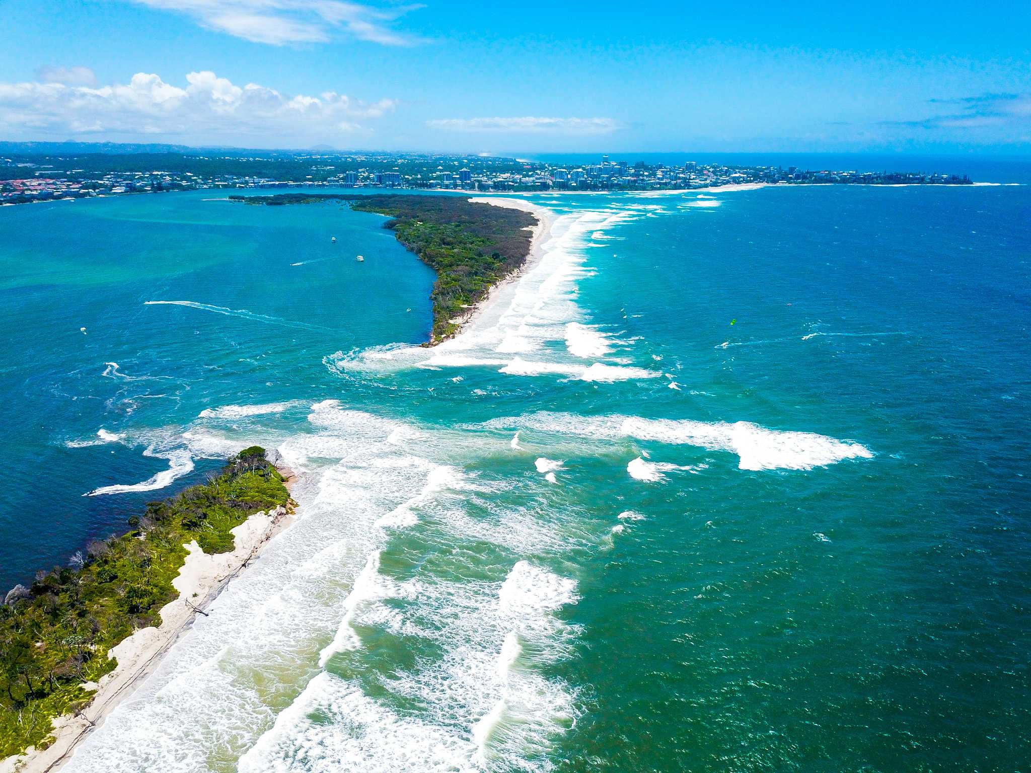
Island’s changing face
A king tide and then the predicted big swell could further alter the northern end of Bribie Island and surrounds.
The island was split by a tidal breakthrough earlier this month.
The dramatic breach affected some people along the Pumicestone Passage and there was significant concern from community groups and long-time locals, although the state’s chief coastal scientist said there were no plans for remedial action.
A king tide of 2.1m was due on Tuesday morning, amid a 1.5m swell, before the surf was due to build later in the week.
“The next two days will be very telling,” Coast Guard Caloundra commander Roger Pearce said.
“(Then) the wind will come up big time and it (the swell) is going to be quite large from Thursday on.”
“There’s about 50m (of the new northern island) at the top end of the breakthrough that’s badly eroded, so I expect there will be more debris in the water soon.”
Mr Pearce said the northern bar, north of the island and near Caloundra, “is silting up a lot”.
“At low tide, there are two sand spits that are coming together. Every day they are getting closer and closer.”
“It (the swell) could change it all completely. Every day the sand has moved.”
