
Sunshine Coast Council has unanimously approved the acquisition of more than 2500sqm of privately owned land to resolve a public road encroachment issue.
The decision was carried at the ordinary meeting on January 29, following consideration of a council officer’s report that outlined the need to formalise the corridor along River Road at Maroochy River.
According to the report, parts of the constructed road have gradually shifted over time and now extend on to private property.
“This section of road provides access to land holdings owned by council, Unitywater and the state government for the Blue Heart project,” it said.
“Essentially, parts of the constructed road sit outside of the gazetted road corridor and impact on private property.
“The gazetted road initially measures approximately 20 metres wide as a sealed section but narrows to about 6.5 metres as a rural gravel road in certain sections.
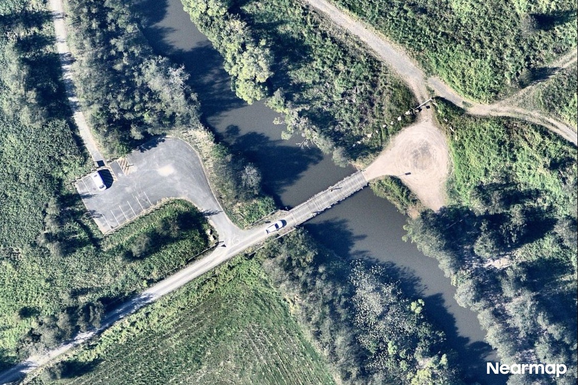
“Over time, as the road has been maintained, its alignment has shifted at certain points, resulting in encroachment onto private property.”
“To address the public road encroachment, council proposes acquiring a portion of privately owned land to establish a consistent 20‑metre gazetted road corridor along the entire length of River Road.”
The council is not proposing to undertake any works to upgrade or realign the actual road but only to increase the width of the road corridor.
The total acquisition area is about 2653sqm, and the council has already reached an in-principle agreement with the landowner.
“The proposed land acquisition area is approximately 13 metres north of the existing road corridor boundary, extending along the private property boundary,” the report said.
“This will increase the road corridor width to approximately 20 metres from the sealed section of River Road to the bridge.”
Related story: Wetlands transition starts in blue carbon trial
Compensation has been assessed by an independent registered valuer but the exact terms were kept confidential by the council.
“The total costs associated with the proposed land acquisition includes the market value of the land as determined by an independent and registered valuer, survey plan preparation fees, Titles Queensland registration fees, legal fees and costs associated with the relocation of the boundary fence,” the report said.
“These funds will be made available through council’s operational budget for expenditure in financial year 2025-26.”
Settlement was expected to occur within 14 days of the council resolution, with boundary fence reinstatement works scheduled to be completed by February 28.
The aerial imagery in this story is from Australian location intelligence company Nearmap. The company provides government organisations, architectural, construction and engineering firms, and other companies, with easy, instant access to high-resolution aerial imagery, city-scale 3D content, artificial intelligence data sets, and geospatial tools to assist with urban planning, monitoring and development projects in Australia, New Zealand and North America.
