
The Sunshine Coast could face an intense and unpredictable summer, with conditions likely to increase the potential for severe storms, heavy rainfall and cyclones.
A Bureau of Meteorology spokesperson told Sunshine Coast News there was a higher risk of severe weather than usual this wet season.
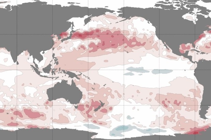
“Waters off Australia’s east coast, particularly off Queensland and in the Coral Sea are currently significantly above average, which is likely to increase the potential for severe thunderstorms, including high intensity rainfall and large hail for eastern Australia in the coming months,” they said.
The region has already been hit by significant storms, in late October and early November, and more are on the way.
“Severe thunderstorms are very likely to affect the Sunshine Coast,” the spokesperson said.
“The highest impacts (will) tend to be localised, but severe thunderstorms are expected to continue impacting the region.”
The east coast storm season is at its peak from October to December, when severe storms can include damaging (90km/h+) and destructive (125km/h+) wind gusts, large (2cm+ diameter) and giant (5+cm) hail, and heavy to intense rainfall that can cause flash flooding. The heaviest rainfall usually falls from late December until early March.
The Sunshine Coast was rocked by ex-Tropical Cyclone Alfred last summer.
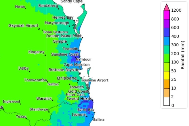
Some locations experienced intense rainfall and flooding, including Nambour, which reported an annual highest daily rainfall record of 365mm on March 10, when more than 180mm fell in six hours. At nearby West Woombye, 244 mm was recorded in six hours.
Significant wave heights of up to 5m were recorded along the Sunshine Coast, there was a shoreline recession of about 30m at Peregian Beach and the tide ultimately broke through Bribie Island from the influence of Alfred.
Want more free local news? Follow Sunshine Coast News on Facebook, LinkedIn and Instagram, and sign up for our FREE daily news email.
The spokesperson said the region faced a greater chance of being affected by cyclones this coming summer and beyond.
“Recent trends show that the tropics are expanding further south in the Southern Hemisphere. So, there is an increasing likelihood that tropical cyclones may affect more southerly regions than in the past,” they said.
The spokesperson said more severe cyclones could form off the state’s coast in coming months.
“Waters off Queensland are currently significantly above average. Warmer sea surface temperatures can provide increased moisture and energy that can enhance rainfall intensity and increase the severity of tropical cyclones.”
It is rare for a tropical cyclone to directly impact South-East Queensland. Notable systems included Alfred in 2025, Nancy in 1990 and Zoe in 1974.
Generally, the region’s cooler waters provide less energy, and increased winds disrupt the structure of the systems.
“However, a cyclone further away or the remnants of a tropical cyclone moving nearby (like Alfred) can still impact the Sunshine Coast and both are more common than a direct tropical cyclone in the region,” the spokesperson said.
“Such systems can produce heavy rainfall and flooding, damaging wind gusts, abnormally high tides, storm surge and dangerous surf.”
The tropical cyclone season runs from November until April.
The spokesperson did say that although sea surface temperatures and related severe conditions were increasing, generally due to climate change, the weather could still be unpredictable, so there was still some potential for fewer severe storms in coming months.
“While on a global scale, and even an Australian scale, we are seeing consistent warming trends in sea surface temperatures, we still anticipate substantial year to year variability in more localised regions,” they said.
