
Sunshine Coast Council is investigating further safety fixes at a notorious intersection that one resident says is like “Russian roulette” to cross.
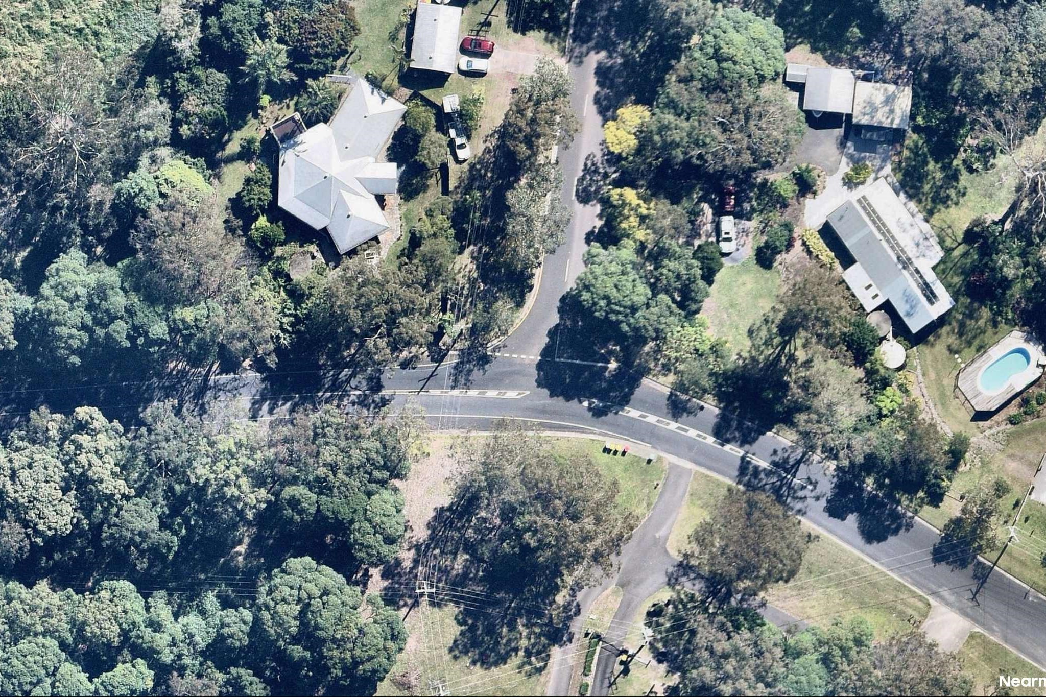
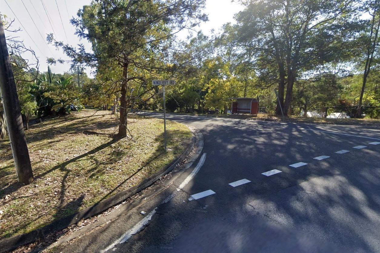
Local Kerry McLean said the junction of Ninderry Road and Elouera Drive – near a bus stop and access to the Mount Ninderry Walking Track – was “unnerving and stressful” to navigate.
A council spokesperson told Sunshine Coast News that some upgrades had been made at the site, and there was the potential for further works, but Ms McLean called for more to be done urgently.
“For over 30 years, this intersection has been the sole access point for many residents and it has unfortunately remained a source of danger due to the lack of adequate safety measures,” she said.
“Many locals call it Suicide Hill. You are taking your life in your hands every time you cross that intersection.”
Residents have launched a petition, following a Yandina and District Community Association meeting, that is expected to be submitted to council.
Ms McLean said the junction’s blind spots put drivers and pedestrians on edge.
“You look left, look right, reassure yourself and do this again many times, then a car goes flashing past. It is Russian roulette.”
Ms McLean, who said roads in the area could get busier amid plans for new walking tracks in the nearby reserve, admitted the terrain made some safety options, such as a ‘give way’ sign or roundabout, difficult.
“Shaving off the top of the ridge would seem to be the best and safest solution … but too expensive. If council cannot find a solution, maybe the best case is to close the road to locals only,” she said.
Sunshine Coast mayor Rosanna Natoli met with locals before she was elected last year and said some upgrades had since been made, with more being considered.
“I am asking that the bus stop location be looked at to determine whether it meets safety standards or whether it can be moved further away from the corner, to improve safety for children getting on and off buses daily,” she said.
A council spokesperson said monitoring over the past 18 months had delivered improvements such as enhanced line marking, new signage, reflector guideposts, vegetation clearing and yellow line marking to discourage parking near the corner.
Want more free local news? Follow Sunshine Coast News on Facebook, LinkedIn and Instagram, and sign up for our FREE daily news email.
They said about 1145 vehicles travel through the junction daily, which “does not currently meet thresholds for major intervention under council’s risk-based prioritisation framework”.
But they said further work could be carried out.
“We recognise that local conditions, such as the intersection’s location on a crest and bend, present unique challenges,” they said.
“A project request has been submitted to the Transport Capital Works program to explore more substantial upgrades, including potential realignment of the intersection.
“Other community suggestions, such as vehicle-activated signage and traffic mirrors, have also been investigated. While not currently feasible due to site constraints and national standards, council continues to explore viable alternatives.
“While not all improvements can be delivered immediately, this location will continue to be assessed as part of ongoing network planning, with a focus on identifying practical, evidence-based solutions in collaboration with the community.”
The aerial imagery in this story is from Australian location intelligence company Nearmap. The company provides government organisations, architectural, construction and engineering firms, and other companies, with easy, instant access to high-resolution aerial imagery, city-scale 3D content, artificial intelligence data sets, and geospatial tools to assist with urban planning, monitoring and development projects in Australia, New Zealand and North America.
