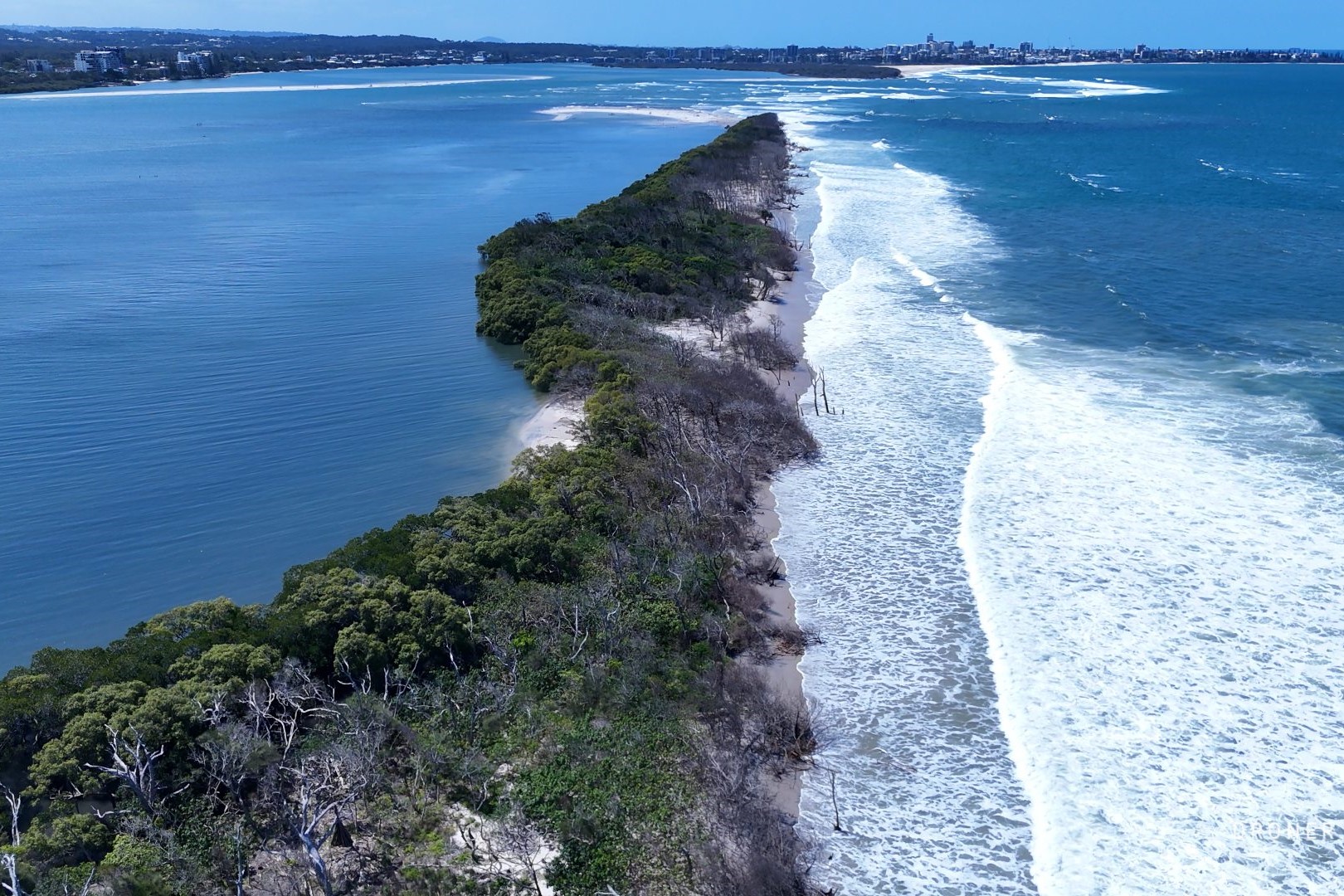
Aerial footage has revealed just how much the tide is affecting an island off the Sunshine Coast, amid suggestions there could be another breakthrough there.
Damien Lange’s timelapse video via drone shows tidal overwash at two sections of Bribie Island, from March until October.
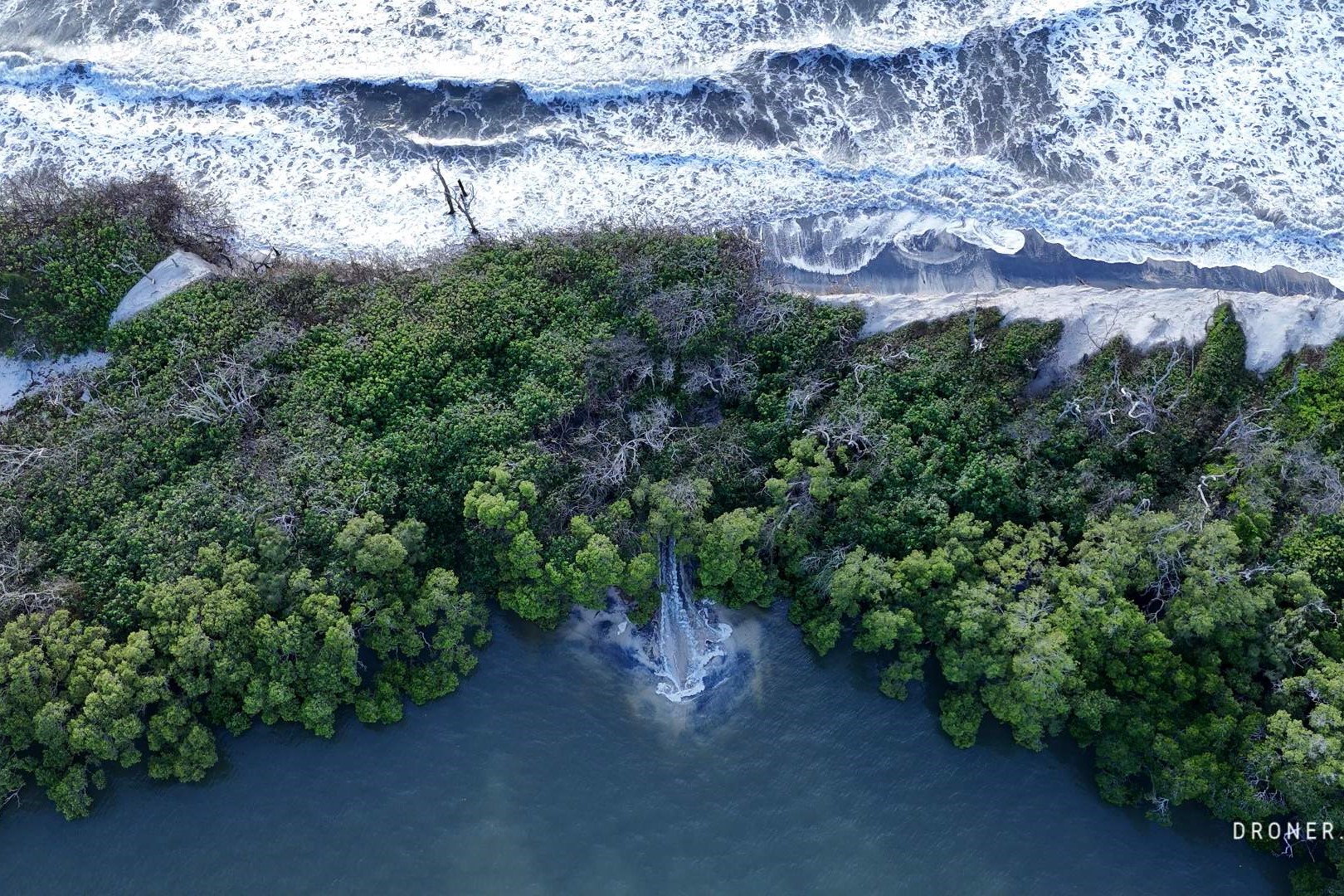
It shows the ocean going over the narrow stretches of the isle, destroying vegetation and pushing large chunks of sand into the Pumicestone Passage.
It comes after a large tidal breakthrough occurred in early 2022, which split the northern tip of the island in two.
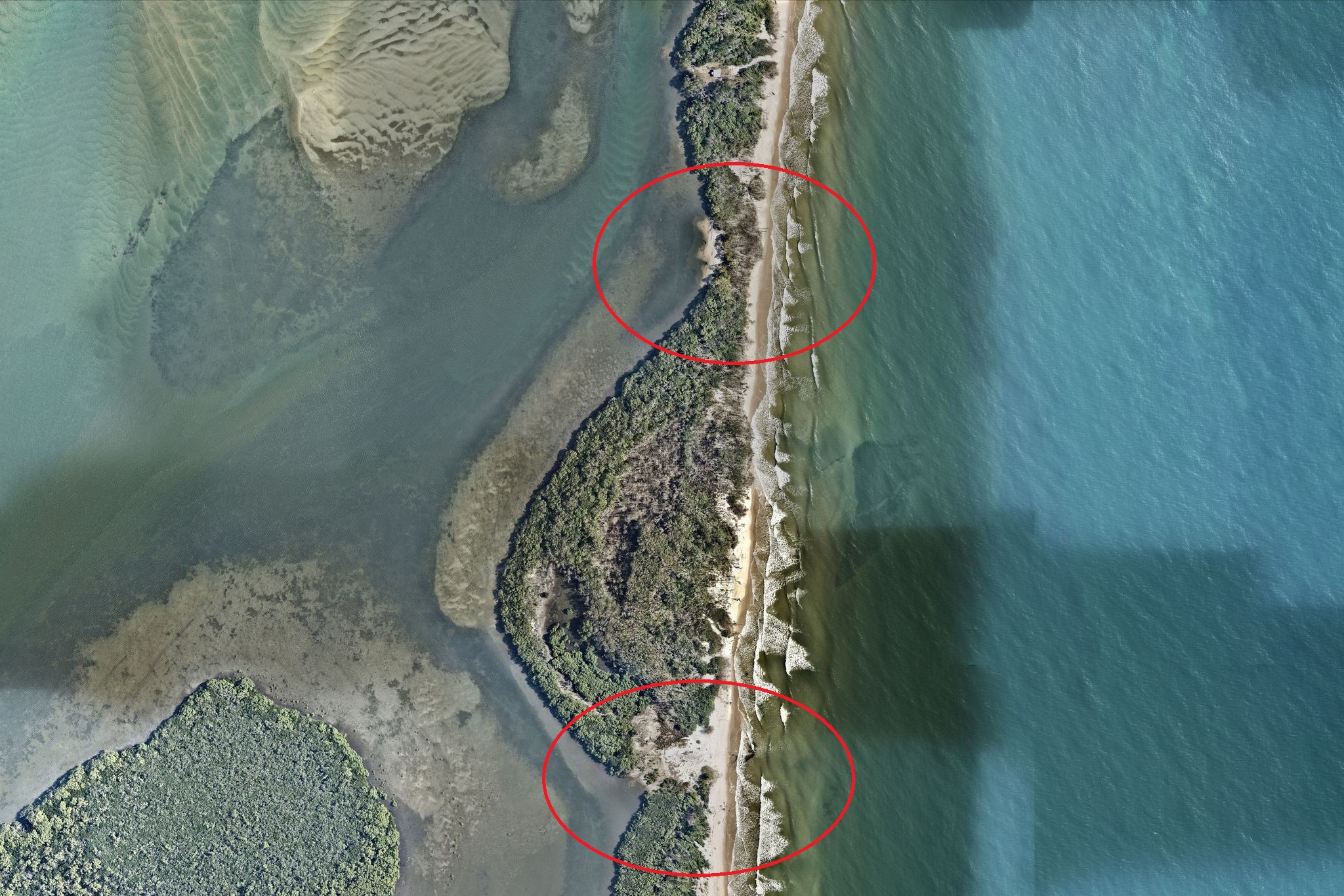
Mr Lange took photos of a couple of slender parts of the island in February and has videoed them since. They include a section near Lions Park, opposite Military Jetty on the mainland, and an area about 500m south, opposite Bells Creek on the mainland.
“I started filming them in March,” he said.
“There’s been progression since then (on high tides).
“Back then, there was water rolling through but it had only just started doing that.
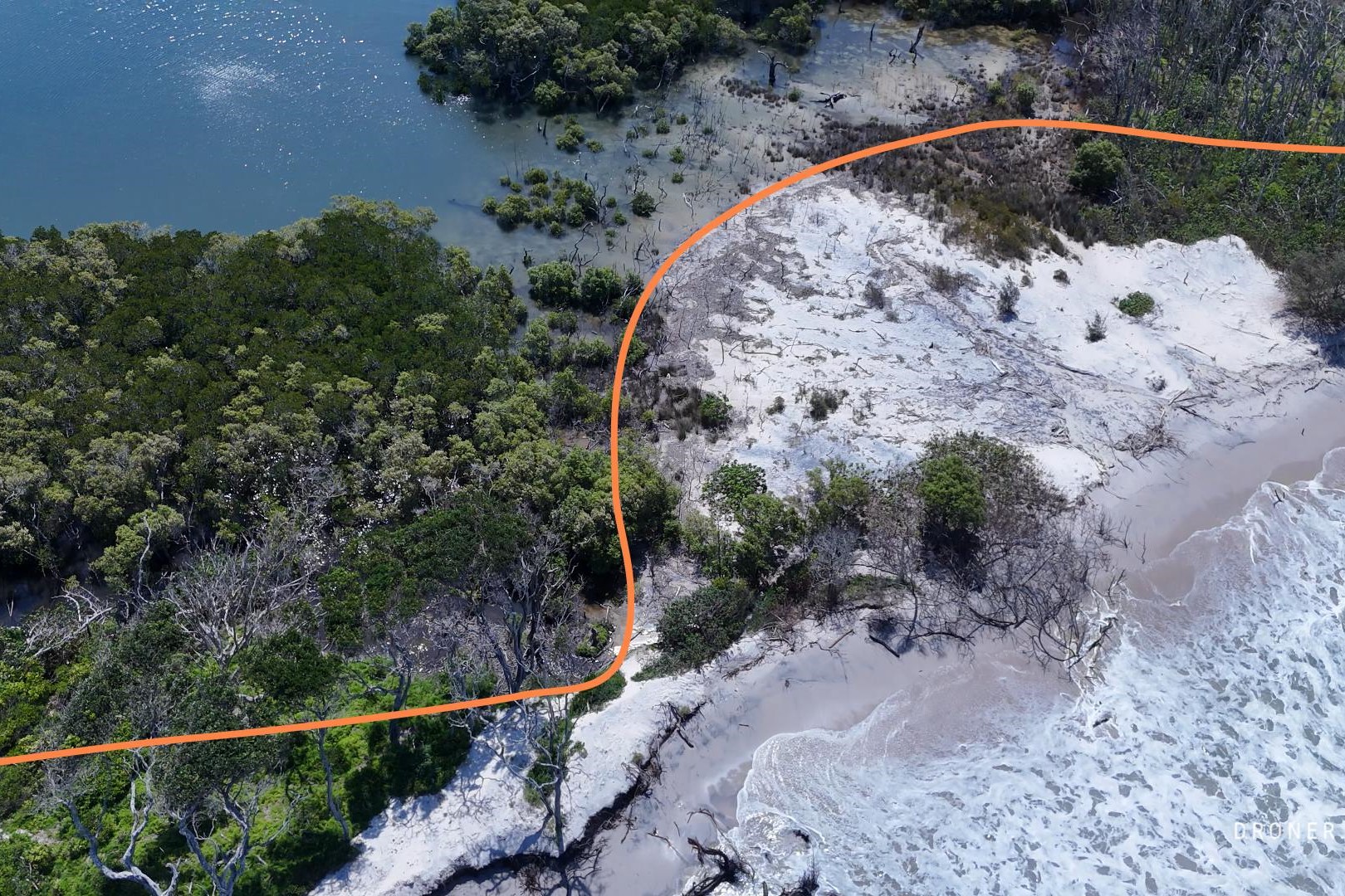
“Now, the water has transferred sand from the ocean side of the island and there is no beach there left any more.
“And a beach is forming in the passage because the sand has been pushed from the island.”
Do you have an opinion to share? Submit a Letter to the Editor at Sunshine Coast News via news@sunshinecoastnews.com.au. You must include your name and suburb.
He said it was “only a matter of time” before that section near Lions Park would be overrun by water and another breakthrough created.
“It’s just waiting for that combination of a storm and a tidal surge.”
Mr Lange said the area further to the south is “getting bigger and wider” and the strip of land there was getting narrower.
“It’s thinning out … there is only about six to seven feet between the ocean and the Pumicestone water.”
A Department of Environment, Science and Innovation spokesperson said the state government was observing the northern reaches of Bribie Island.
“We’re monitoring environmental changes at Bribie Island, including ongoing beach erosion south of the Pumicestone Passage entrance (the breakthrough) along the island’s eastern side,” they said.
“Wave action has eroded the dunes at the northern end of the island and wave overwash of the low-lying areas during recent storms has damaged vegetation and carried sand into the passage.”
They said sand was being pushed into the passage, and that another tidal breakthrough was unlikely but could happen in extreme weather.
“Our monitoring shows that wave washover events will likely continue along the northern tip of the island and more sand will slowly migrates westward,” they said.
“A sandy beach has formed in mangroves south of Lions Park by this process.
Related story: Tide study says passage turning to open coastline
“While the formation of new permanent tidal channels at the northern end of Bribie Island are possible, they’re highly unlikely to occur without extreme weather events. This dynamic coastal environment is undergoing natural changes over time.”
University of the Sunshine Coast Associate Professor in Physical Geography Javier Leon said the main breakthrough seemed to have “stabilised” with “a nicely developed ebb-tide delta/bar at the mouth and a dynamic flood-tide delta/shoals migrating shoreward”.
He has also noticed the two narrow sections of the island where water has flowed at times.
“There is a spot around 1.5km south of the breakthrough that has experienced several wash-overs since at least 2006,” he said.
“The site, opposite Bells Creek, was identified in the Pumicestone Task Force Breakthrough Study of 2007.”
He said it was unlikely there would be a breakthrough there soon but it could happen in extreme weather.
“This is currently the narrowest, low-lying section with no established vegetation of Bribie Island and the most likely location of a potential breakthrough.
“However, the chances of this happening in the short-term remain low.
“The chances of a breakthrough in this area will be higher under a combination of higher water levels and large and frequent east or north-easterly waves, such as those caused by back-to-back cyclones or east coast lows during spring tides.”
He outlined what effects that would have.
“The impacts of a breakthrough at this spot would be very similar to the ones we have observed since the past breakthrough.
“We would expect sediment being reworked, resulting in changing channels and shoals that could impact mangrove and seagrass ecosystems and modify water flow, potentially increasing flooding and erosion hazards along the coast.”
He said it was unlikely the ocean would break through other areas of the island because they are “wider, higher and have vegetation cover”.
“All of these factors mitigate erosion.”
The aerial imagery in this story is from Australian location intelligence company Nearmap. The company provides government organisations, architectural, construction and engineering firms, and other companies, with easy, instant access to high-resolution aerial imagery, city-scale 3D content, artificial intelligence data sets, and geospatial tools to assist with urban planning, monitoring and development projects in Australia, New Zealand and North America.
