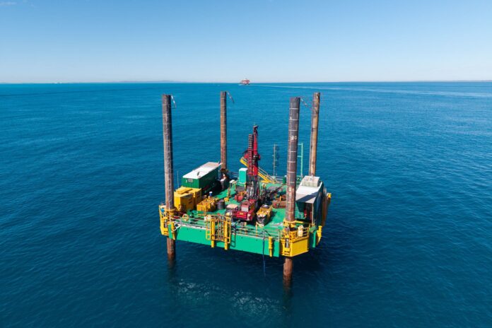
A drilling barge spotted off the Sunshine Coast has been carrying out work linked to a multibillion-dollar shipping channel project.
The unusual sight caught the attention of Caloundra locals, who took to social media to ask what it was doing there.
A Port of Brisbane spokesperson confirmed it was being used for marine geotechnical investigations in the North-West Channel as part of the proposed Channel Enhancement Project, which would deepen and widen shipping access to the state’s capital.
The investigations are being undertaken at multiple sites between the Sunshine Coast and Brisbane from June until September.
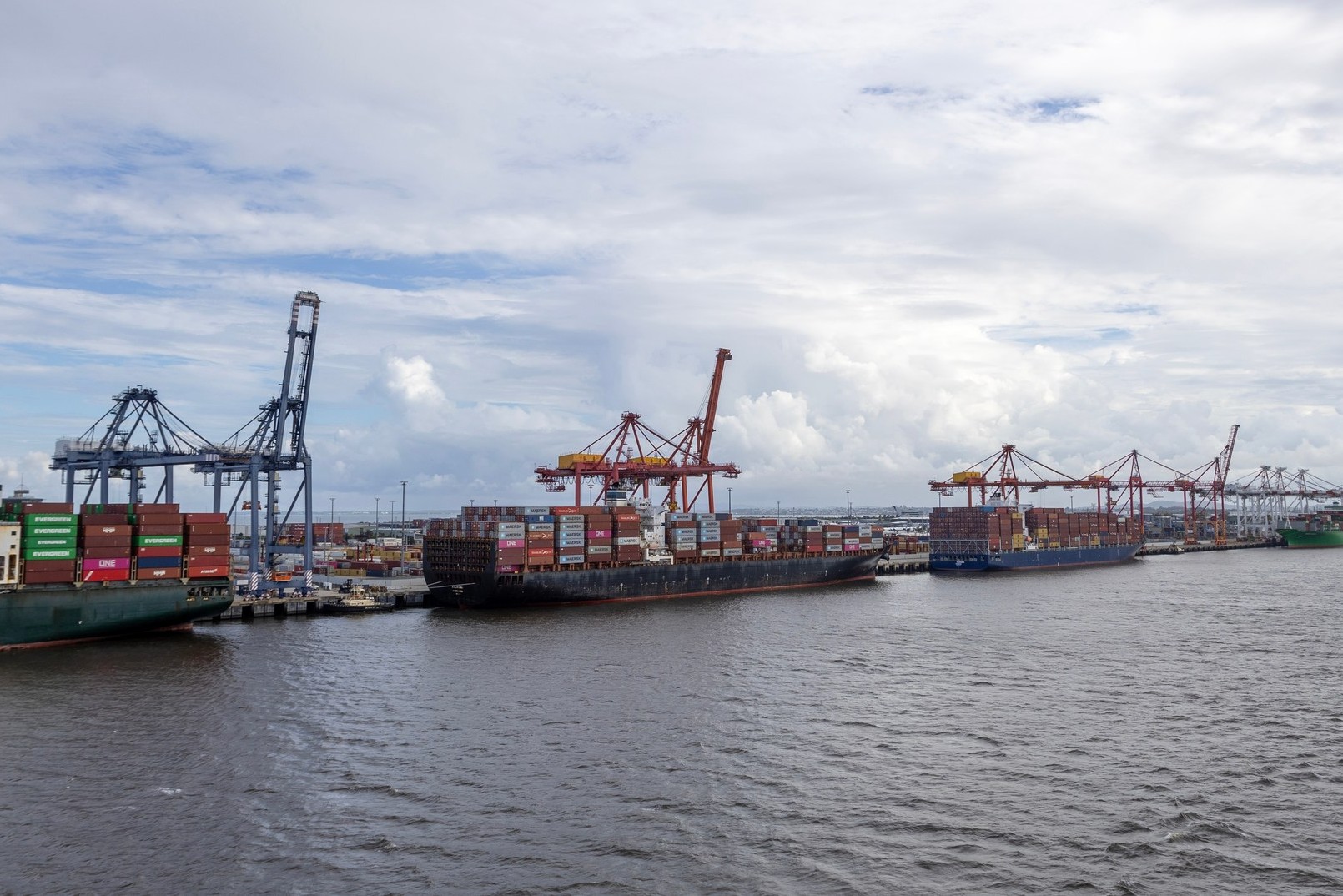
“The CEP is a proposed 25-year infrastructure program of works, aimed at preparing the port for future trade and population growth in South-East Queensland,” the spokesperson said.
“The CEP is being designed to ensure the primary shipping channel remains safe, efficient and capable of supporting larger, modern vessels into the future.”

The project includes deepening, widening and realigning several navigational channels “to improve navigational safety and flow”.
The proposed changes could increase general channel depth from about 15m to 17.3m, while the width of the North-West Channel could increase from about 250m to 500m.
Maritime Safety Queensland issued a Notice to Mariners in late July, advising of core sampling operations in the vicinity of the North-West Channel, East Knoll Bypass, East Channel and Outer Bar.
It stated that the works would be carried out by the jack-up barge Ocean Driller II.
The investigations form part of the project’s Environmental Impact Statement (EIS) study. The draft EIS is expected to be lodged in mid-2027 and will be available for public consultation.
Locals will also get to know more about the project at a series of community drop-in information sessions in September and October, including at Caloundra and Bribie Island.
“The sessions will provide community members with an opportunity to meet directly with the project team, learn more about the proposed project, understand the EIS process and discuss the studies currently underway,” the PoB spokesperson said.
Do you have an opinion to share? Submit a Letter to the Editor at Sunshine Coast News via news@sunshinecoastnews.com.au. You must include your name and suburb.
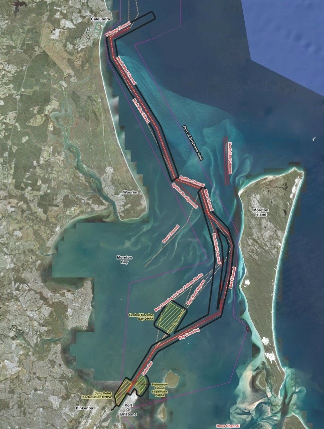
A June project update stated that there was a “a focus on the North-West Channel, supported by engineering consultant WSP and archaeological consultant Cosmos Archaeology”.
It also provided further details about the investigations at multiple sites in Moreton Bay.
“Geotechnical testing … will collect information about seabed conditions,” the update said.
“Understanding the type and strength of marine sediments will help inform the safe design of the project. Archaeological assessment of the samples will help inform the underwater cultural heritage study.
“The investigations involve localised sampling activities carried out from a specialised, temporary jack-up barge (18.5m x 18.5m) geotechnical drill rig and survey boats within existing port limits.
“These activities may include drilling of small-diameter (~100mm) boreholes into the seabed with samples collected at selected depths; geophysical survey at selected locations utilising a small boat; (and) limited diver sampling of surface seabed material where required.
“Each sampling location is expected to be occupied for a short period only, after which equipment will be removed and activities will move to the next location.
“The investigation will not disturb mangroves, seagrass, reefs or shoreline areas and will be approved as a scientific research activity in the Moreton Bay Marine Park.
“Environmental management measures will be in place to control turbidity, prevent spills, and manage waste which will be collected and disposed of at approved facilities onshore.”
Sunshine Coast conservation group Take Action for Pumicestone Passage commented, via social media in early August, about the project.
“Many locals have recently been asking about the large drilling platform visible offshore around Happy Valley and Kings Beach.”
“For communities at the northern end of the shipping channel, including Caloundra and the Pumicestone Passage, understanding the potential impacts on coastal processes, marine ecology and water quality will be particularly important as the EIS progresses.
“TAPP will continue following the project closely and participating in opportunities for community and stakeholder engagement.
The Department of Development, Infrastructure and Planning stated last year that the project would involve dredging about 96.5 million cubic metres of material, and the “beneficial reuse and disposal of the dredged material”, with investigations underway to determine where dredged sand could be relocated.
Related story: Proposal to widen and deepen shipping channel detailed