
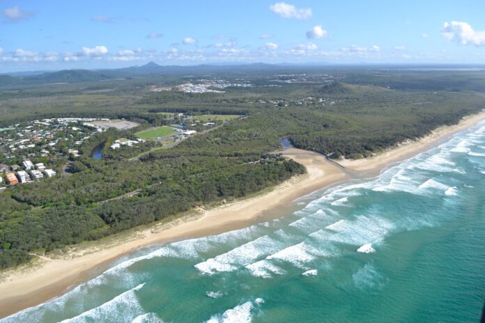
The road, parking and pedestrian arrangements at a well-used coastal recreation area will be assessed by Sunshine Coast Council.
More than $67,000 has been allocated for investigations and design work regarding access to Stumers Creek at Coolum Beach.
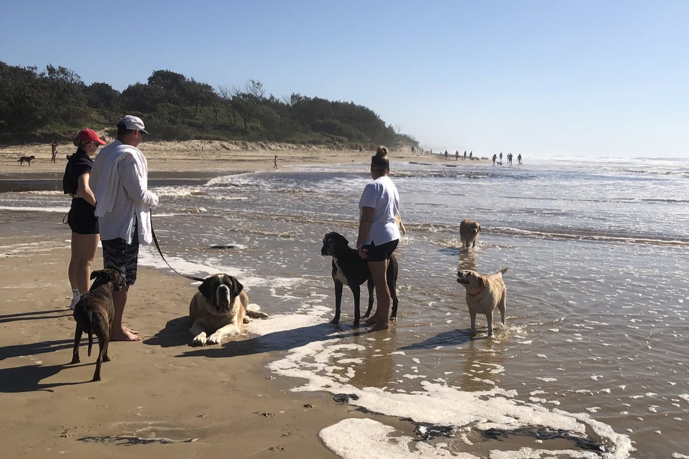
The increasingly busy location, beside a national park, attracts surfers, fishers, dog walkers, sky divers and other visitors.
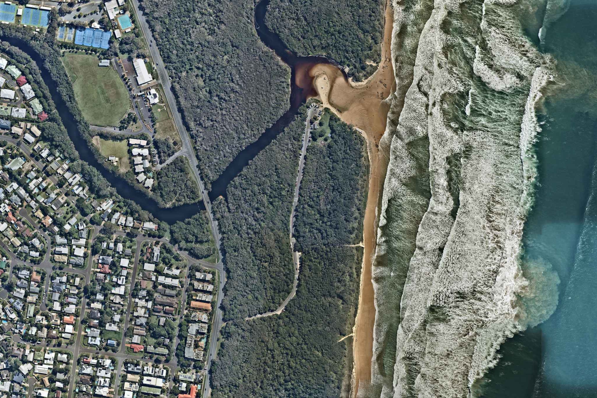
It is serviced by a narrow two-way undivided road that branches off coastal thoroughfare David Low Way.
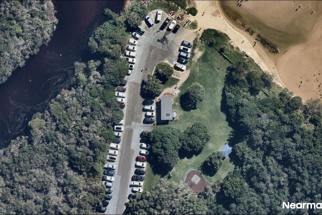
The road has a speed limit of 40km/h and traffic calming measures, and pedestrians access the beach primarily via a grassed verge.
There are 16 marked parking spaces, as well as several informal verge and unmarked parking areas, near a tight turnaround point by the creek. Overnight parking is prohibited to help manage illegal camping.
A council representative confirmed that changes could be made.
“Council has allocated funding in FY27/28 for feasibility investigations, community engagement and design work to assess potential improvements to vehicle and pedestrian beach access at Stumers Creek,” they said.
“The project is in its early stages and will explore opportunities to provide a safer, more consistent beach access for the community, Council and emergency responders.
“Reliable access is important for emergency response activities, including marine pollution incidents and marine animal strandings.”
Help us deliver more news by registering for our FREE daily news feed. All it requires is your email at the bottom of this article.
The spokesperson could not speculate on what the possible changes could be but said that locals will have input.
“No design has been finalised and it is too early to comment on specific improvements or construction timeframes.”
“Potential options will be informed by technical assessments, site investigations, community consultation and detailed design work.
“More information will be available as options assessments, design development and due diligence investigations progress. Any future construction works would be subject to the outcomes of these investigations, future funding and council approval processes.”
Council did not have recent pedestrian or vehicle count data available for the location, but there have been no reported crashes at this location during the past five years.
The council has not identified any significant traffic operation or road safety issues associated with the road access or the intersection with David Low Way, while parking related concerns have generally been limited to illegal overnight camping.
The aerial imagery in this story is from Australian location intelligence company Nearmap. The company provides government organisations, architectural, construction and engineering firms, and other companies, with easy, instant access to high-resolution aerial imagery, city-scale 3D content, artificial intelligence data sets, and geospatial tools to assist with urban planning, monitoring and development projects in Australia, New Zealand and North America.