
Sunshine Coast Council says it is in no rush to progress plans for a seawall along a beach that requires regular costly maintenance.
A wall has been touted as a long-term solution at Maroochydore, where a battered 2km stretch of coastline stands between the elements and a built-up urban area.
The wall was highlighted in the Shoreline Erosion Management Plan (SEMP) 2025-2035 Part 2, compiled for council by extreme weather engineering experts Jeremy Benn Pacific.
The report stated that plans for a wall “to protect the beachfront and assets between Alexandra Headland and Maroochydore” were approved in 2015, with responsibility shared by council and state government.
It stated that the approval was linked to an expected future beach width trigger set on a distance between assets and the coastline. This requires the ‘toe’ of the frontal dune to be reduced to 15m from Okinja Road following an erosion event.
Want more free local news? Follow Sunshine Coast News on Facebook, LinkedIn and Instagram, and sign up for our FREE daily news email.

“Currently the beach exceeds this width, however within the lifetime of this SEMP extreme storms may erode the beach to the required trigger point and initiate the next steps towards construction,” it read.
But council has not set a timeline for possible works and is expected to continue with a costly initiative – the Maroochydore Beach Renourishment Program – undertaken roughly every two years.
This year’s works, which ran from June until mid-September, cost $750,000.
Works have been carried out eight times during the past 12 years.
A council spokesperson said the program was effective.
“Given the ongoing success of the current renourishment program at Maroochydore Beach in providing an erosion buffer between the ocean and council infrastructure, there is no timeline proposed for construction of a seawall in this location,” they said.
“Sand renourishment, dune revegetation and protection, and limiting beach access points are all part of the current shoreline management approach.
“Planning for and building a seawall is a complicated and lengthy process and would need to be clearly communicated to the community. A seawall in this location has been identified as the last line of defence and council is not progressing any plans at this stage.”
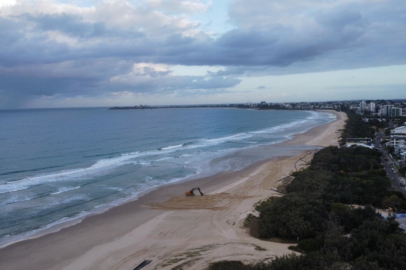
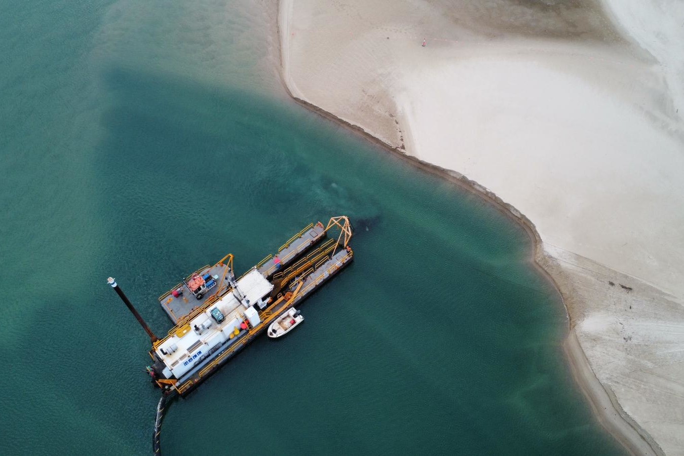
The renourishment program involves a dredge that collects sand from the lower Maroochy River and sends it to Maroochydore Beach via a pipeline and booster pump.
This year’s campaign was expected to see 50,000 cubic metres of sand relocated, following the impacts of ex-Tropical Cyclone Alfred.
A new sand nourishment campaign was trialled in 2022, when a ship sprayed sand from Moreton Bay into the nearshore zone about 300m off the beach.
Seawalls have been completed, are being built and are being planned at several beaches around the region, including at Mooloolaba, Golden Beach, Kings Beach, Moffat Beach and Noosa Main Beach.
The aerial imagery in this story is from Australian location intelligence company Nearmap. The company provides government organisations, architectural, construction and engineering firms, and other companies, with easy, instant access to high-resolution aerial imagery, city-scale 3D content, artificial intelligence data sets, and geospatial tools to assist with urban planning, monitoring and development projects in Australia, New Zealand and North America.
