
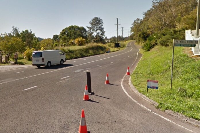
A slim stretch of a key Sunshine Coast link road is about to get a significant upgrade, including the addition of cycle lanes.
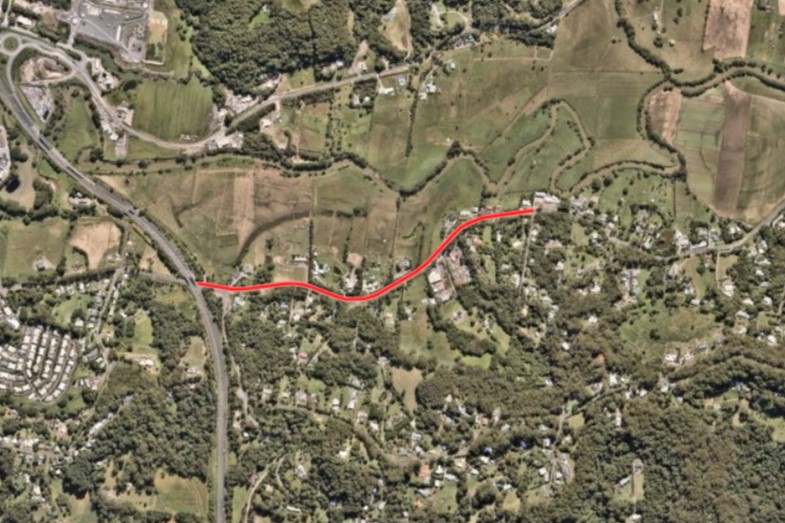
The 1.2km section of Petrie Creek Road, between Paynters Creek Road and Sugarview Lane at Rosemount, is poised for a revamp with funding of $5.7 million from Sunshine Coast Council and the state government. There are also plans to widen the stretch from Sugarview Lane to Celestine Place, although funding is yet to be secured for this.
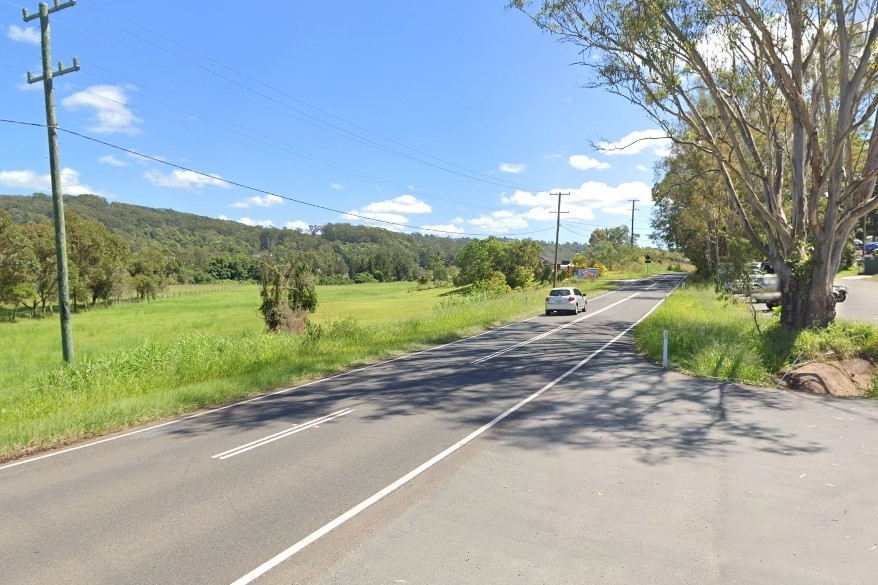
The winding route – a historic key connector between Nambour and Maroochydore – currently has shoulders less than half a metre wide, forcing cyclists and motorists into close proximity and creating safety concerns.
A Sunshine Coast Council spokesperson detailed the expected changes on the road, which accommodates more than 5000 vehicles and bikes per day.
“As part of the upgrade, each road shoulder will be widened approximately three metres to incorporate a designated on-road cycle lane on both sides,” they said.
Want more free local news? Follow Sunshine Coast News on Facebook, LinkedIn and Instagram, and sign up for our FREE daily news email.
“In addition, the project will address sub-standard road geometry, improve sight distances, renew the ageing pavement and upgrade drainage and signage.
“It also includes safety features such as turn lanes, guardrails and lighting at the Paynters Creek Road intersection.
“These improvements will enhance safety for all road users and reduce conflict between vehicles and cyclists.”
There have been several accidents on the stretch in recent years.
“The proposed upgrades will mitigate roadside risks and improve overall safety for the future,” the spokesperson said.
Early works are due to start in August, with major construction starting later in the year.
The upgrades should be completed by early 2027.
A Sunshine Coast Bicycle User Group spokesperson said the road is an “essential connection” and detailed its condition.
“Currently, there are mostly very narrow shoulders with sections of road with steep drops into open drainage channels,” they said.
“The current situation is a risk to cyclists and motorists alike and this is why there have been vehicle-activated advisory signs placed along this section advising caution.
“There is nowhere safe for cyclists to ride. Cyclists ride close to or on the edge line requiring vehicles to cross over the centre line to use safe legal passing distances. Most do, however there are those who pass extremely closely, which is dangerous and nerve-racking for riders.
“Heavy vehicles also use this road, adding to concerns.”
The spokesperson said the upgrades would be “most welcome”.
They said it would “fill in the missing link and make the route much more usable, while making this section safer for both cyclists and motorists”.
“Vehicles will be able to pass at a safe distance giving cyclists space to ride safely,” they said.
“The ride would be much more enjoyable and attractive.”
The spokesperson said recreational riders used the route but more people would be inclined to ride along there once the upgrades are completed.
“Most use would currently be for recreational and sport riding. Numbers would be limited for commuting and utility trips, however, this would be expected to increase once safe facilities were available.”
Councillor Ted Hungerford said investment in the project was a “highlight” in council’s budget.
“(It) will complete vital verge and cycleway links from David Low Way to Nambour,” he said.
“While construction will take time, I look forward to completion of this important infrastructure project: creating a more connected and liveable community for all our residents.”
The project has been split into two stages after the concept design was completed and the cost estimation determined.
Stage 1 is funded from the Bruce Highway underpass (near Paynters Creek Road) to Sugar View Lane and is 1.2km
Stage 2, from Sugar View Lane to Celestine Place, is unfunded. Council was expected to seek funding opportunities.
A previous project provided wider shoulders on each side of the road from David Low Way to Celestine Place.
A separate project has delivered cycle lanes from under the Bruce Highway to Howard Street in Nambour.
The aerial imagery in this story is from Australian location intelligence company Nearmap. The company provides government organisations, architectural, construction and engineering firms, and other companies, with easy, instant access to high-resolution aerial imagery, city-scale 3D content, artificial intelligence data sets, and geospatial tools to assist with urban planning, monitoring and development projects in Australia, New Zealand and North America.