
A storm tide study by an engineering firm specialising in extreme weather has recommended that areas on the Sunshine Coast be identified for protection by seawalls.
The study, by JBP, also says that the force of waves will need to be considered in the structural integrity requirements of some new buildings.
A report on the study was prepared for this week’s Sunshine Coast Council meeting and replaces the council’s currently adopted storm tide study that was prepared in 2013.
The new study makes specific mention of the ocean breakthrough at the northern end of Bribie Island during high tides and large waves from Cyclone Seth in December 2021.
It says the breakthrough has led to a change in wave action and an increase in tidal range in the Pumicestone Passage, where the mean low tide is 21cm lower than it used to be and the mean high 26cm higher.
The 2024 study suggests that the passage conditions are starting to replicate those of the open coastline.
“The increases in observed tides reflect conditions that more closely align with the open coast,” the study says.
“A similar trend is expected with storm tide levels, which are now anticipated to be more representative of open coast levels.”
The study says ongoing erosion and recession is expected on the Coast’s beaches, particularly at Golden Beach.
“The protection offered by Bribie Island is not considered a permanent feature due to ongoing erosion, recession and the recent breakthrough,” it says.
“All future scenarios consider the northern end of Bribie Island to be completely eroded. Under this scenario Golden Beach becomes the open coastline with a potential erosion zone extending back to The Esplanade.”
The meeting was told that increased storm tide levels as a result of the Bribie break-through had already been factored in during the 2013 study.
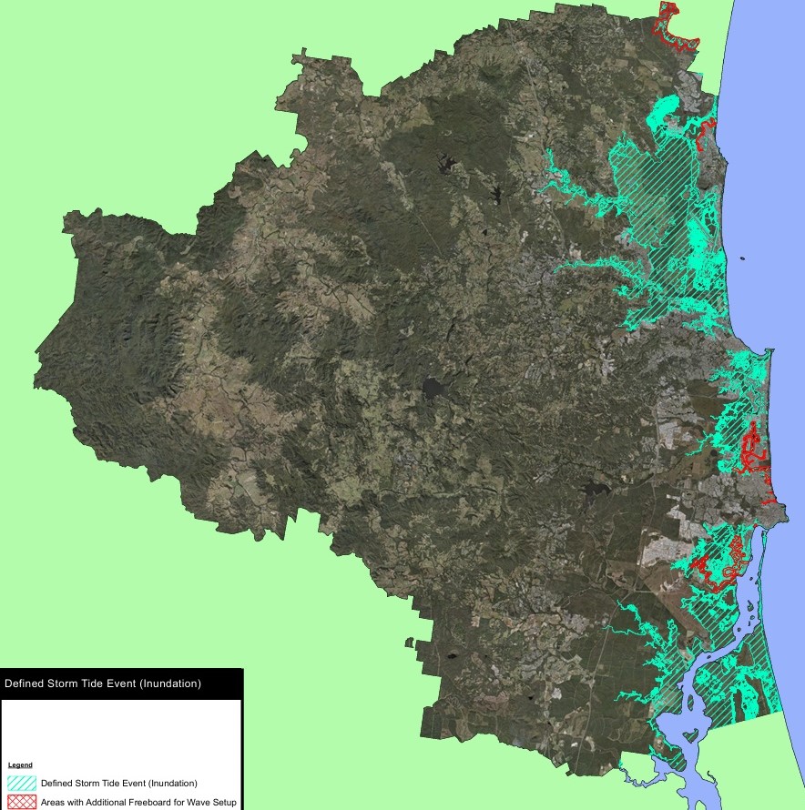
However, the new study also factored the effects of wave set-up – an increase in water height brought about by waves – on storm tides in rivers and estuaries.
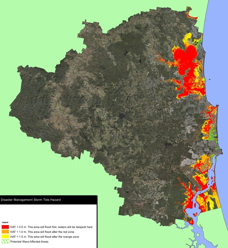
It says that the theoretical maximum storm tide estimate including a tide-plus-storm surge-plus-wave set-up, is 1.5m higher than what has been regarded as the worst-case scenario
Anywhere with an average sea level height less than 4.7m, or within 200m of the Golden Beach Esplanade, should be considered within the wave zone, and buildings within the wave areas should be built to endure the wave forces.
Speaking at the meeting, division two councillor Terry Landsberg, said the council would need to advocate strongly for more funding to protect foreshore areas.
“Potentially, you’re looking at $100m just to do the seawall along Golden Beach to protect those assets and that’s not even talking about the public infrastructure and what we have to do,” he said.
Natural Assets Group Manager Bill Haddrill said conversations at state and federal government level had already begun happening.
Yesterday’s meeting also endorsed a recommendation to increase the freeboard level – the minimum floor height above water – by 0.4m.
Councillors were told the freeboard height increase would affect about 850 blocks, mostly at Pelican Waters, and all but about 50 were already built upon.
The height of the remaining blocks meant the 0.4m freeboard increase would only have a 0.15m effect on building heights, the meeting heard.
The study recommends that high-quality water gauges should be installed in coastal creeks as some are not robust enough to deal with the increased water levels and that coastal recession should monitored.
Help keep independent and fair Sunshine Coast news coming by subscribing to our FREE daily news feed. All it requires is your email at the bottom of this article.
