
More details have been unveiled for a major upgrade of a crowded intersection.
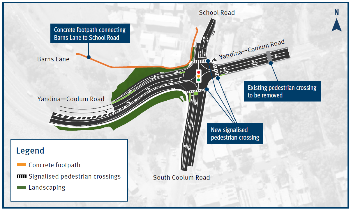
Detailed designs have been released for a new-look four-way junction near Coolum State School. It can be bumper to bumper at peak times.
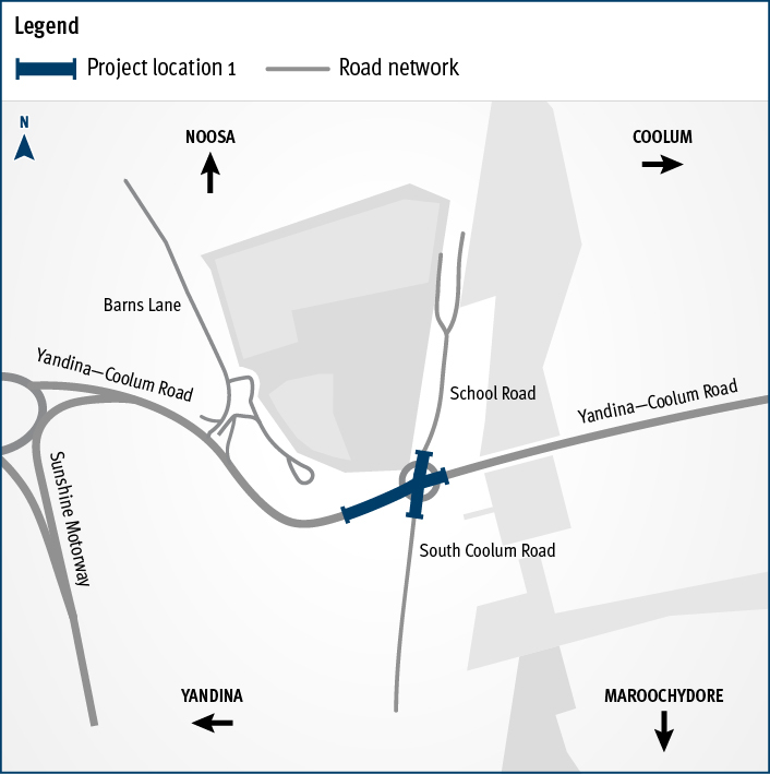
The existing roundabout – at the intersection of Yandina-Coolum Road, South Coolum Road and School Road – will be replaced by a traffic signal-controlled intersection.
The $5 million upgrade is designed to mitigate congestion, particularly around the school, and improve safety for pedestrians and bike riders.
The tender process for the delivery of the new intersection will start early this year.
Do you have an opinion to share? Submit a Letter to the Editor at Sunshine Coast News via news@sunshinecoastnews.com.au. You must include your name and suburb.
Regular updates will be provided to key stakeholders and the community once the tender process concludes and construction timeframes are confirmed.
Acting Minister for Transport and Main Roads Scott Stewart said the upgrade would significantly alleviate congestion.
“We are making Coolum Beach safer and improving traffic flow,” he said via a TMR media release.
“This government is committed to addressing the current bottleneck at the Coolum roundabout.
(Traffic lights) will improve traffic flow by prioritising heavy traffic demand during morning and afternoon peaks.
“Construction timing is still to be confirmed and we will be back out to the community in the coming months with this information.”
It’s one of two intersections at Coolum Beach that are set to be overhauled.
A new pedestrian refuge will be built at the intersection of David Low Way and Scrub Road near the beach.
The improvement is set to facilitate safe crossings for pedestrians.
The $1.2 million project also includes the introduction of a dedicated right-turn lane and speed limit adjustments.
To minimise disruptions for road users, works will be undertaken overnight.
“Works are expected to start soon and will take approximately two months to complete, weather and construction conditions permitting,” Mr Stewart said.
“We understand construction activities can be frustrating and acknowledge the cooperation and patience of the Coolum community during construction.”
The aerial imagery in this story is from Australian location intelligence company Nearmap. The company provides government organisations, architectural, construction and engineering firms, and other companies with easy, instant access to high-resolution aerial imagery, city-scale 3D content, artificial intelligence data sets, and geospatial tools to assist with urban planning, monitoring and development projects in Australia, New Zealand and North America.
Subscribe to our FREE daily news feed. All it requires is your name and email at the bottom of this article.
