
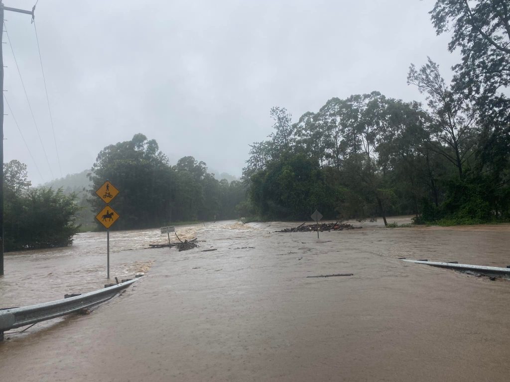
Torrential downpours of up to 445mm have fallen on parts of the Sunshine Coast since midnight, leaving hinterland towns cut off as roads flood and swollen rivers overflow.
The Bureau of Meteorology has warned to expect up to 300mm more rain as a wet weather system lurks over a huge swathe of southern Queensland, from Bundaberg to the Gold Coast.
In its latest bulletin at 11am, the bureau predicted more rain with “embedded thunderstorms” and winds around 90km/hr for Friday and Saturday.
Already the incessant rain has turned roads into rivers and caused the region’s dams to overflow as they reached up to 152 per cent capacity.
Townships like Kenilworth and Imbil have been cut off as bridges went under and residents were urged not to drive on flooded roads.
The highest rainfall totals across Queensland since midnight were:
- Pomona 445mm
- Cooran 410mm
- Hills Road 329mm
- Moy Pocket 315mm
- Mt Glorious 280mm
- Toowoomba 124.8mm
All the region’s dams are spewing waterfalls as soaked catchments cause them to overflow.
Baroon Pocket Dam is at 109.5 per cent, Borumba Dam 122.5 per cent, Cedar Pocket 152.1 per cent, Cooloolabin 112.2 per cent, Ewen Maddock 115.2 per cent and Lake Macdonald 130.9 per cent.
A moderate flood warning is in place for the Mary River which winds through the Kenilworth region before reaching Gympie.
There’s also a moderate flood warning for the Noosa and Maroochy rivers and a flood warning for the Mooloolah River and Coochin Creek.
The BOM said the wet was caused by a “deepening and slow-moving surface trough that extends from near Hervey Bay down to a developing low pressure system near Biggenden and over the eastern Darling Downs”.
It would “continue to produce areas of heavy rain with embedded thunderstorms”.
“Heavy rainfall which may lead to flash flooding is forecast to continue over parts of Southeast Queensland today and potentially through Saturday morning,” the BOM update said.
“Six-hourly rainfall totals between 80 and 120mm are likely, reaching up to 180mm over areas east of Gympie to Jimboomba.
“Locally intense rainfall leading to dangerous and life-threatening flash flooding is possible with thunderstorms during this period, particularly over areas north of Brisbane.
“Six-hourly rainfall totals in excess of 300 mm are possible.”
Severe Weather Update: Major flooding, torrential rain continues for south-east Qld. Video current: 11.30am AEST 25 February 2022
Know your weather, know your risk. For the latest forecasts and warnings, go to our website https://t.co/2vzF7RvxgQ or the #BOMWeather app. pic.twitter.com/w1ySMUYS3k
— Bureau of Meteorology, Australia (@BOM_au) February 25, 2022
SES volunteers have received more than 100 calls for assistance from residents in the Sunshine Coast and Moreton Bay regions.
The conditions also forced the suspension of Surf Life Saving Queensland’s 2022 Youth State Championships.
SLSQ urged all competitors and spectators to stay away from both venues: Alexandra Headland and Mooloolaba. It will continue to provide updates throughout the day.
Sunshine Coast Airport diverted multiple flights because of extreme rain causing low visibility.
Some flights were diverted to Brisbane Airport and all travellers have been advised to keep updated on the website or through your airline.
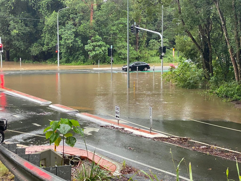
Sunshine Coast Council has asked residents to keep off the roads if possible.
With the ground already soaked and waterways swollen, authorities predict more rain could significantly impact areas across the Coast, including flash flooding.
Sunshine Coast Local Disaster Management Group Chair, Mayor Mark Jamieson, said: “I would also ask for the community to stay away from water courses as fast-moving waters can be incredibly treacherous.
“Even a small amount of water on the road is extremely dangerous for you and your passengers, as well as the emergency service workers who may be called to assist you,” Mayor Jamieson said.
“Remember, if it’s flooded, forget it.”
Noosa’s Local Disaster Manager Group (LDMG) has issued a warning to residents in the shire.
“With flash flooding a real risk, and the potential for landslips, residents are advised to stay home as much as possible, and avoid travelling on the roads unless absolutely necessary.
“As the ground is saturated, fallen trees are now also a risk.

“Council crews are out and about putting road closed signs in place where possible, but due to the weather not all flooded roads will be signed.”
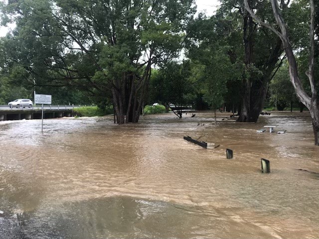
Noosa said that as of 9.30am, Kin Kin and Cooran were isolated.
With more than 330mm of rain falling on Pomona, various roads in that area were also under water.
Cooroy Library and the Pomona Waste Transfer Station are closed and the Mobile Library will not be operating Friday.
For the latest information, see Council’s Facebook page – facebook.com/noosacouncil – and the Disaster Dashboard – disaster.noosa.qld.gov.au
Local journalists supporting local people. Help keep independent and fair Sunshine Coast news coming by subscribing to our free daily news feed. All it requires is your name and email. See SUBSCRIBE at the top of this article
The BOM said an upper low would move slowly eastward across southern and southeast Queensland during Friday.
“A deepening surface trough that extends from around Bundaberg down through the central Wide Bay and Burnett, and into the Darling Downs will continue to produce rain areas and thunderstorms to its east.
“Uncertainty remains regarding the exact location of the heaviest and most significant rainfall.”
The latest alert comes as the death toll from the deluge has risen to two.
Police are investigating the death of a man after his motorcycle was located in floodwaters at the side of Cedar Pocket Road.
The 54-year-old Cedar Pocket man left his place of work at about 1am Wednesday and it is believed he was swept away at about 1.30am.
“Police commenced a meticulous, two-day search of the area, assisted by swift water specialists, specialist police divers, SES and air support,” a QPS spokesperson said.
“At about 11.30am Thursday, the man’s body was located, when divers were able to access an area that had been previously too dangerous to search, near where the motorcycle was located. Investigations are ongoing and police will prepare a report for the coroner.”
This followed the death of a 63-year-old woman who died when her vehicle was engulfed west of Eumundi on Wednesday morning.
