
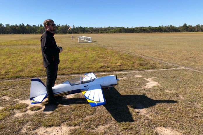
An application to establish a model aircraft flying facility on a rural property has progressed to public consultation.
The proposal would allow Suncoast Model Fliers to establish an outdoor sport and recreation facility across land at 801-845 Yandina-Coolum Road and 76-88 Dynes Road, Valdora.
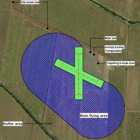
The development application seeks approval for flying operations in addition to grass runways, a pilot shade structure, a small amenities and storage building and 10 car parking spaces.
It is the latest step in the club’s lengthy efforts to secure a permanent home after losing access to its former base at the Coolum Industrial Estate.
Sunshine Coast News previously reported the application was lodged in May, following an earlier proposal that attracted significant community opposition over potential noise, safety and environmental impacts.
That application was refused by Sunshine Coast Council last year and the club subsequently lodged an appeal.
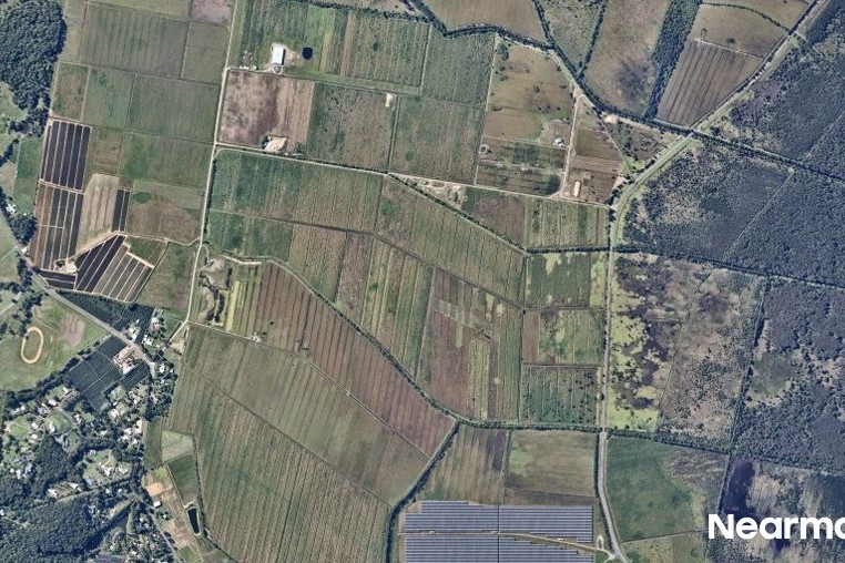
Planning documents state the club has spent more than seven years investigating potential relocation options across the region.
Since the current application was lodged, the applicant has provided further information after council sought additional detail about noise, the types of aircraft proposed, wind impacts and potential effects on animals and surrounding rural activities.
The new material includes a revised noise assessment incorporating additional testing and tighter proposed operating controls.
New background noise monitoring was undertaken in the Valdora township area in August after council sought data that better represented homes to the west of the proposed facility.
The new monitoring found the area was relatively quiet during the day, so the revised assessment has set a stricter limit on how much noise from the flying club could be heard at nearby homes. The report says this tighter standard will now be used to assess the proposal instead of the earlier approach.
The revised material also sets out more specific restrictions on flying operations.
A maximum of one turbine or jet aircraft, one petrol or internal-combustion aircraft, or two electric aircraft would be allowed in the air at any one time.
General operating hours are proposed from 7am to 4pm, seven days a week as weather permits, with flying not to begin before 9am on Sundays and public holidays.
The east-west runway would be the primary runway, while the north-south runway could be used when required because of wind or operational safety.
An acoustic consultant has also recommended limiting prolonged full-power engine running, keeping an operational and complaint register and undertaking further compliance monitoring if required by council.
Do you have an opinion to share? Submit a Letter to the Editor at Sunshine Coast News via news@sunshinecoastnews.com.au. You must include your name and suburb.
Potential effects on animals have also been addressed in a separate expert statement provided as part of the applicant’s response to council.
Animal behaviour specialist Dr Andrew McLean recommended the club contact adjoining landholders each year to identify sensitive periods such as foaling, lambing or bird nesting.
The proposed approach would allow flying hours or aircraft types to be temporarily limited following consultation with affected neighbours during those periods.
Dr McLean also addressed a resident’s concern about black cockatoos moving between Peregian Beach and Valdora.
He stated the flying site was about 1.2km from the nearest bushland and said he was not aware of research specifically linking model aircraft with black cockatoo disturbance.
His assessment concluded the development would not pose an unacceptable risk to animal welfare, safety or amenity.
Public submissions for the proposal opened on September 14 and can be made until October 5.
Submissions can be lodged electronically via mail@sunshinecoast.qld.gov.au or sent to Sunshine Coast Council, Locked Bag 72, Sunshine Coast Mail Centre, Queensland 4560.
The aerial imagery in this story is from Australian location intelligence company Nearmap. The company provides government organisations, architectural, construction and engineering firms, and other companies, with easy, instant access to high-resolution aerial imagery, city-scale 3D content, artificial intelligence data sets, and geospatial tools to assist with urban planning, monitoring and development projects in Australia, New Zealand and North America.