
The chair of an apartment block residents’ group is calling on authorities to improve road safety in her neighbourhood, saying ongoing traffic issues are putting locals at risk.
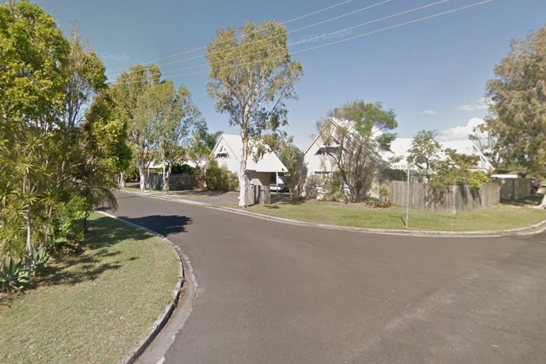
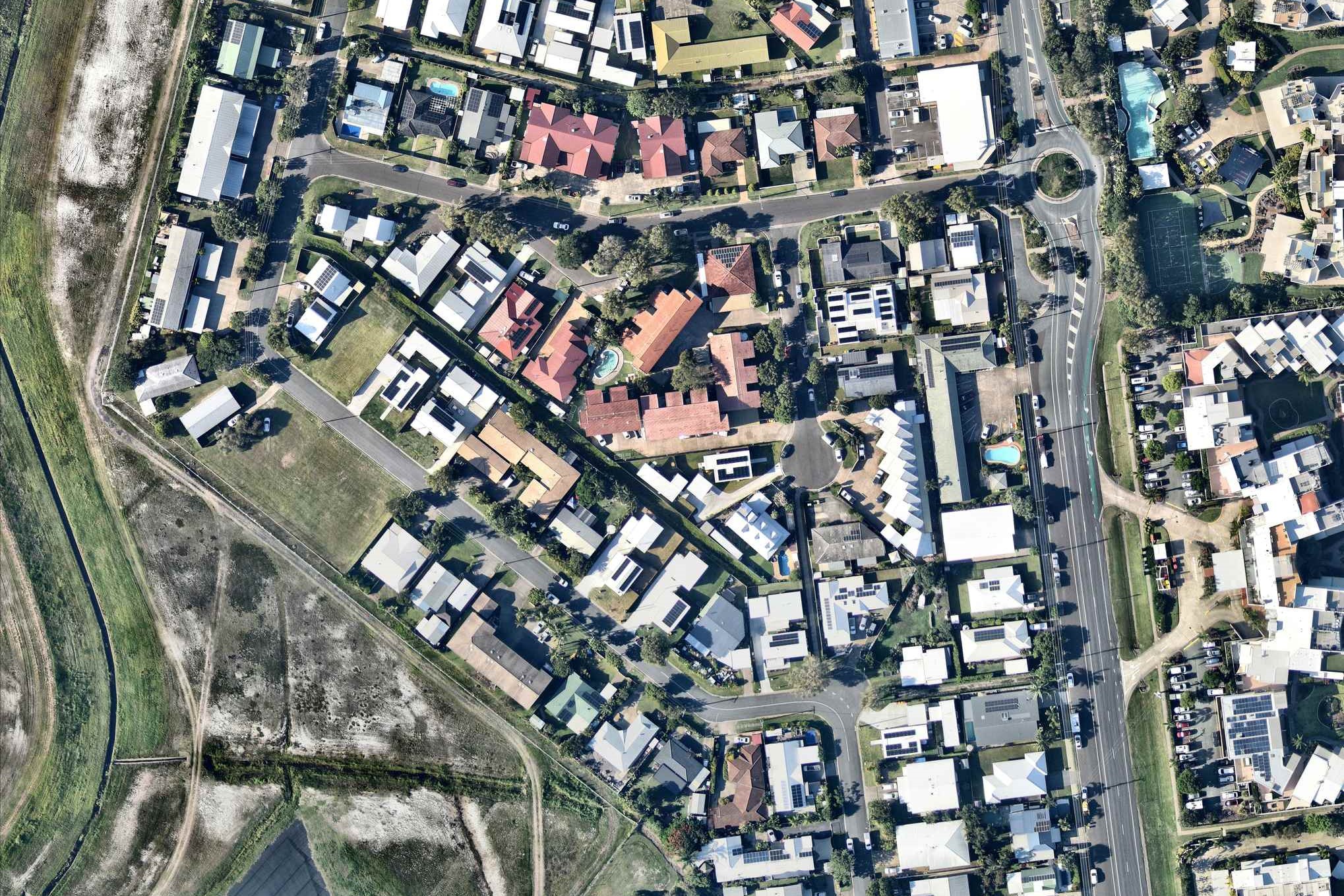
Marie-Joelle Berner told Sunshine Coast News that an increased number of vehicles and parked cars has created hazardous sections of roads at Keith Royal Drive and Rex Avenue at Marcoola.
A Sunshine Coast Council spokesperson admitted there was likely more cars in the area and several “requests” had been made to improve safety there. Officials stated that the speed limit was 50km/h and some measures had been put in place to help address concerns, while police say they actively patrol the area.
But Ms Berner, who has lived at the Kaylors Court apartment precinct for 20 years, says more should be done.
“Over this time, we (local residents) have seen a big increase of traffic and car parkin,” she said.
Scroll down to SUBSCRIBE for our FREE news feed, direct to your inbox daily.
“This is creating a big issue for us trying to get in and out of our driveway.
“It’s quite dangerous, in some cases when we are unable to see cars coming from northbound Keith Royal Drive or turning south from Rex Avenue.”
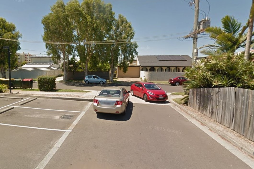
Ms Berner said there were problems along Rex Avenue, from the chemist at the David Low Way roundabout to the T-intersection with Keith Royal Drive.
“Especially when cars are parked on both sides of the road and especially when cars are trying to go in and out of the chemist on Rex Avenue.”
“It’s crazy and only (a matter of) time for major dramatic accidents to happen.”
She said the area had been largely ignored.
“Speed limits and traps have put in a lot of places around the Sunshine Coast districts,” she said.
“Keith Royal Drive and Rex Avenue should have been addressed already, especially with … a lot more people driving around. Shame.”
The council spokesperson said Keith Royal Drive and Rex Terrace were classified as ‘neighbourhood collector roads’ with a default speed limit of 50 km/h.
“Council’s most recent speed data indicates vehicles are travelling below the posted speed limit (and) parking in the area is typical of residential neighbourhoods, with on‑street parking available.”
The spokesperson admitted that there were likely more vehicles than before.
“There have been no recent traffic volume studies done but, as with many parts of the region, traffic volumes have seen a general increase.”
The spokesperson also said that council received multiple requests to address concerns there and had taken some action.
“Over the past two years, council has received seven requests relating to parking, traffic or road safety on these two roads,” they said.
“Each request has been investigated and responded to directly with the resident. To help address concerns, council has installed additional centre lines on two bends along Keith Royal Drive to improve delineation and discourage parking around bends.”
A Queensland Police Service spokesperson said the area was patrolled.
“The Northern Highway Patrol Group actively conducts speed enforcement around Marcoola, including on Keith Royal Drive.”
“Sunshine Coast Police are committed to continuing enforcement to reduce the number of lives lost on our roads, and keep Queenslanders who are doing the right thing, safe.
“The QPS is committed to reducing the number of lives lost on Queensland roads, and road safety should always be front of mind for all road users.”
The aerial imagery in this story is from Australian location intelligence company Nearmap. The company provides government organisations, architectural, construction and engineering firms, and other companies, with easy, instant access to high-resolution aerial imagery, city-scale 3D content, artificial intelligence data sets, and geospatial tools to assist with urban planning, monitoring and development projects in Australia, New Zealand and North America.
