
A conservation group has raised serious concerns over a proposed road, warning it could damage an ecologically important area.
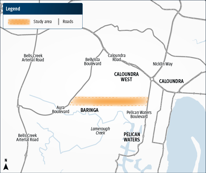
The Sunshine Coast Environment Council says the estimated 2.7km route between Caloundra West and Golden Beach could threaten one of the region’s last remaining intact native habitats.
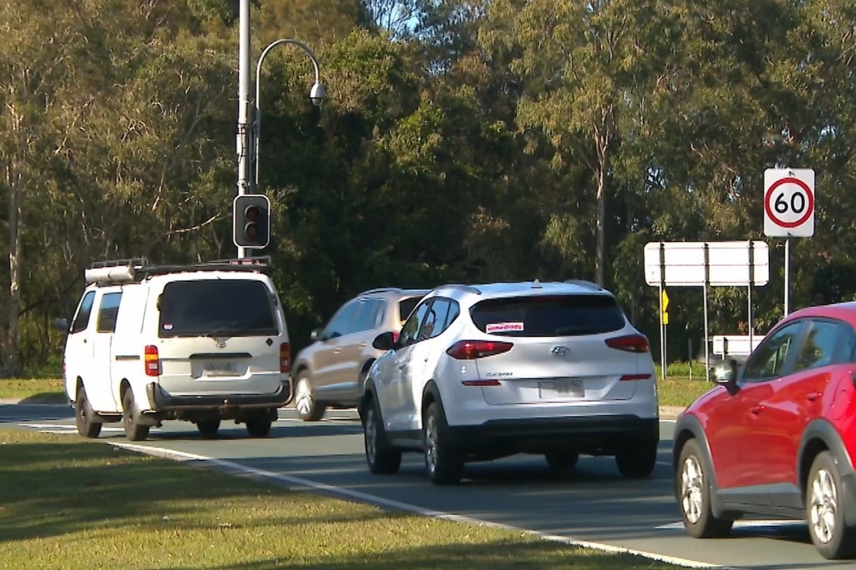
Early planning is under way for the link, which is expected to take traffic off the busy Caloundra Road.
The state government has stressed the need for transport solutions in the area, and the corridor is one of five key projects included in the Caloundra Congestion Busting Plan.
But SCEC advocacy and engagement manager Narelle McCarthy said the proposal was unacceptable in its current form.
“The indicative study area is proposed within the widest section of an ecologically significant area containing Lamerough Creek, important wetlands and high conservation values,” she said.
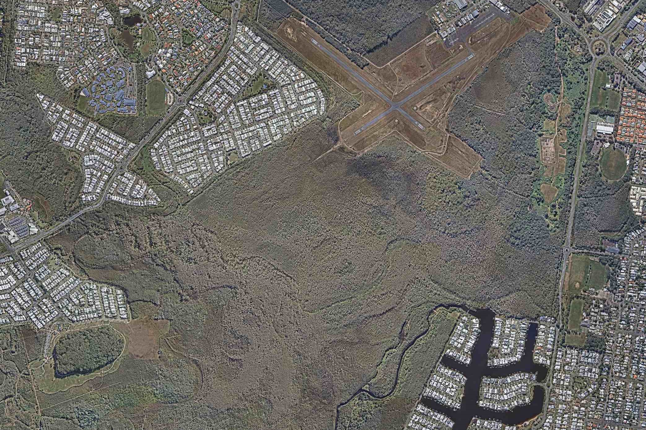
“This portion of the Mooloolah River floodplain also plays a vital role for flood resilience and water quality for surrounding waterways and the Pelican Waters canals.
“It is literally one of the last vestiges of intact native vegetation and habitat in this area, so any incursion must be avoided.”
She offered a different solution – a new road that could complement a planned heavy rail line and train station.
“A less environmentally sensitive and cost-effective alternative would be to combine this new link with the proposed alignment for The Wave,” she said.
“By taking it from the roundabout south of Caloundra South ambulance station and east of the proposed Nirimba railway station, the corridor would be through former pine plantations to connect Bells Creek Arterial Road and Pelican Waters Boulevard.
“This project could then be factored into the planning and environmental considerations for these committed major infrastructure projects.
“Such a route would also service a much larger area of Golden Beach and Pelican Waters and take traffic directly onto Bells Creek Arterial Road.”
Want more free local news? Follow Sunshine Coast News on Facebook, LinkedIn and Instagram, and sign up for our FREE daily news email.
A Department of Transport and Main Roads spokesperson said natural areas were important, the project was in its infancy and extensive studies would be taken.
“Consideration of environmental matters is a priority for the Department of Transport and Main Roads,” they said.
“The project is still in the early planning phase, which includes assessing the feasibility of the proposed route and identifying potential environmental, social and technical considerations.
“A detailed scope of field investigation works will be developed to better understand the vegetation, land use and potential environmental impacts.
“The Queensland Government is committed to the protection and sustainability of the unique Sunshine Coast environment, culture and heritage.”
Investigations are anticipated to start next year.
“As the project progresses, environmental measures will be carefully considered and incorporated where appropriate,” the spokesperson said.
“We understand the community’s interest in protecting the natural environment.
“All necessary investigations and assessments will be undertaken as part of this process to ensure a balanced and responsible approach to planning.”
TMR will liaise with key stakeholders, as well as relevant federal and state government departments to discuss environmental issues and ensure legislative requirements are met.
The aerial imagery in this story is from Australian location intelligence company Nearmap. The company provides government organisations, architectural, construction and engineering firms, and other companies, with easy, instant access to high-resolution aerial imagery, city-scale 3D content, artificial intelligence data sets, and geospatial tools to assist with urban planning, monitoring and development projects in Australia, New Zealand and North America.
