
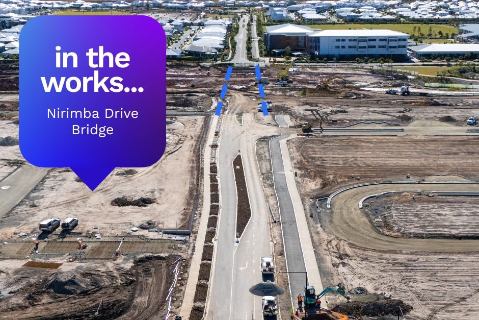
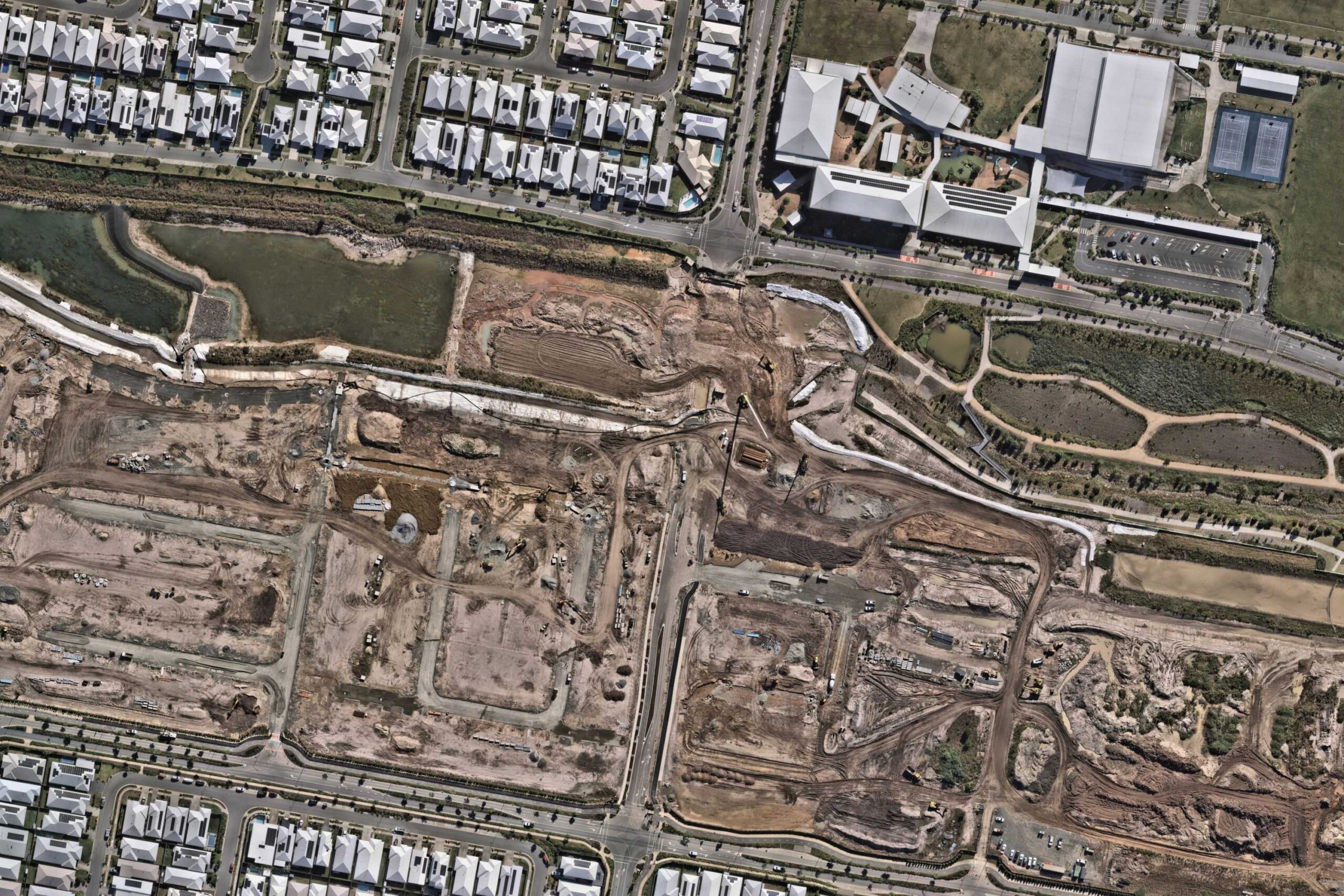
Construction is underway on a bridge that will connect two suburbs in a rapidly growing area of the Sunshine Coast.
The 24m bridge is being built over the Aura Brook and will improve access for pedestrians and motorists travelling between the suburbs.
Works will see Nirimba Drive at Nirimba extended to create a direct link to Banya Avenue at Banya within the master-planned Aura development.
It will also help improve connectivity to Nirimba State Primary School.
The bridge will include two traffic lanes plus a separate 4.8m-wide cycle path and footpath on one side, and a 1.5m-wide pedestrian path on the other.
It will cross the Aura Brook, while a 3m-wide shared path will run alongside the water beneath the bridge.
The path will eventually form part of a continuous off-road active transport network that will extend the 3km length of Aura Brook.
Related story: Work begins on sprawling new parkland with lagoon
Stockland development director Josh Sondergeld said the infrastructure would be a welcome addition for residents in the growing suburbs.
“This new bridge over Aura Brook forms part of Aura’s long-term vision to create an active and connected community,” he said.
“The bridge will improve everyday accessibility between Nirimba and Banya with safe walking and cycling paths above and below the bridge.
“With more than 200km of dedicated walking and cycling paths planned across Aura, infrastructure like this provides safer routes for kids to walk or ride to school, encourages active lifestyles and helps take more cars off the road.”
James Camus, the associate director of bridge designer Urbis, said the structure would reflect the area’s natural surroundings.
“The design of the Nirimba bridge takes inspiration from the natural landscape of the Aura Brook,” he said.
“The angled blue battens reflect the surrounding marsh sedges and create a ripple-like effect that echoes the movement of water through the brook.
“We’ve also designed the spacing and height of the battens to allow a clear view between the bridge and the brook during the day, while helping reduce light spill at night to protect the brook’s natural habitats and wildlife.”
The bridge is expected to be completed in early 2026, subject to weather.
The aerial imagery in this story is from Australian location intelligence company Nearmap. The company provides government organisations, architectural, construction and engineering firms, and other companies, with easy, instant access to high-resolution aerial imagery, city-scale 3D content, artificial intelligence data sets, and geospatial tools to assist with urban planning, monitoring and development projects in Australia, New Zealand and North America.
