
A key intersection on the southern Sunshine Coast is set for a major upgrade, but a local councillor says it could funnel more traffic through beachside suburbs before a bypass is delivered.
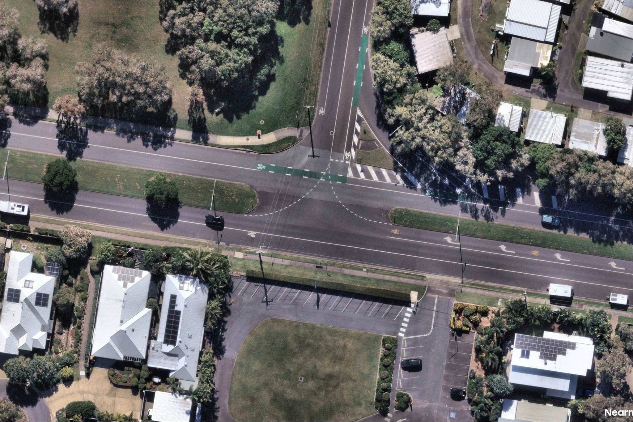
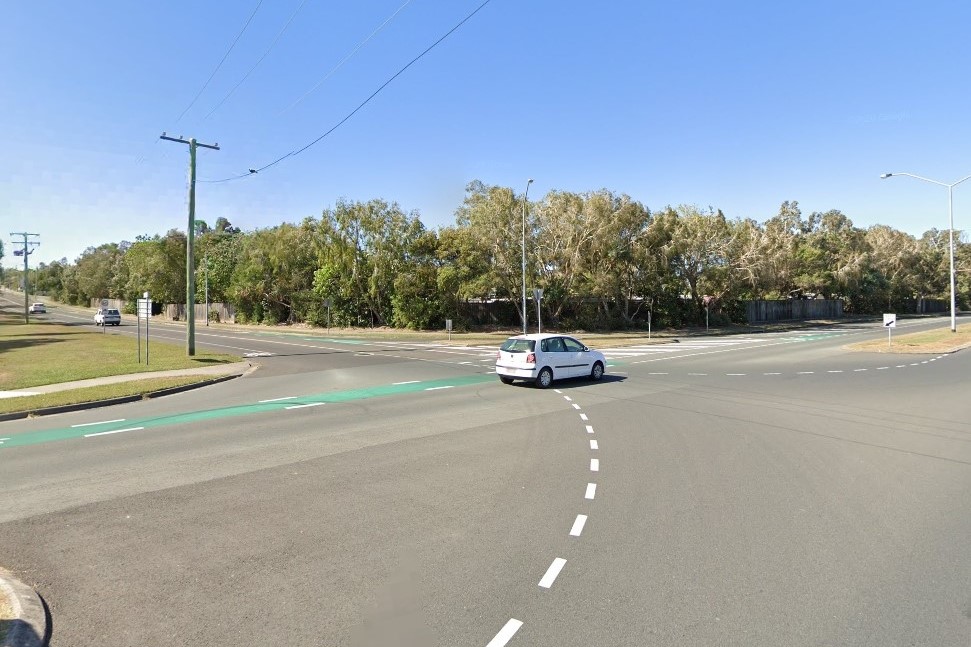
Traffic lights and turning lanes are planned for the junction of Beerburrum and Cooroy streets at Dicky Beach, with more than $1 million allocated in Sunshine Coast Council’s latest budget. The project has received federal Black Spot Program funding to improve safety.
Used by more than 16,000 vehicles a day, the T-intersection has been the scene of multiple accidents involving cars, buses and bicycles.
A council spokesperson said the upgrade would include the removal of the existing slip lane and installation of a signalised crossing with designated turning lanes.
Local councillor Terry Landsberg said he supported measures to improve road safety, especially for vulnerable users, but he questioned the works.
He said the upgrade could encourage more traffic through Dicky and Moffat beaches before the Caloundra Transport Corridor Upgrade is delivered – a project he believes will significantly ease congestion.
Want more free local news? Follow Sunshine Coast News on Facebook, LinkedIn and Instagram, and sign up for our FREE daily news email.
“One of my concerns with this upgrade was: why are we installing a signalised intersection prior to the delivery of the CTCU?” Cr Landsberg said.
“Delivering a major infrastructure upgrade to this transport corridor in Dicky Beach sends a message of accommodating more vehicles on this route into Caloundra off Nicklin Way.”
He said detailed council modelling showed the CTCU could reduce traffic flow in the area by 30 per cent.
“We should be looking at options to reduce the number of vehicles through our beachside suburbs, not deliver upgrades that promote an increase,” he said.
Cr Landsberg also said the loss of on-street parking was a concern.
“Many visitors to Dicky Beach rely on parking along Beerburrum Street to access the patrolled beach,” he said.
A spokesperson for the Caloundra Residents Association said the intersection was a key route between Moffat Beach and Currimundi, including for families heading to local schools.
They said the junction was also difficult to navigate for pedestrians, cyclists and mobility device users, and needed to be improved for safety.
“This intersection is part of the Caloundra to Currimundi Active Transport project, which is currently on hold,” the spokesperson said.
“We would want to see crossings on all four sides, avoidance of two-stage crossings and input from the community – especially children, older people and people with disabilities.”
The council said the project was still in its early stages and would go through detailed design, environmental review and procurement before construction begins.
Works are expected to start early next year and be completed by June 30, in line with Black Spot Program requirements.
Beerburrum Street is a key link between Aroona, Nicklin Way and Dicky Beach.
Last year, smart pedestrian signals were installed at the western end of the street in Aroona.
The technology includes sensors that cancel crossing requests if a pedestrian walks away, and others that keep the light green until pedestrians are safely off the road.
The aerial imagery in this story is from Australian location intelligence company Nearmap. The company provides government organisations, architectural, construction and engineering firms, and other companies, with easy, instant access to high-resolution aerial imagery, city-scale 3D content, artificial intelligence data sets, and geospatial tools to assist with urban planning, monitoring and development projects in Australia, New Zealand and North America.
