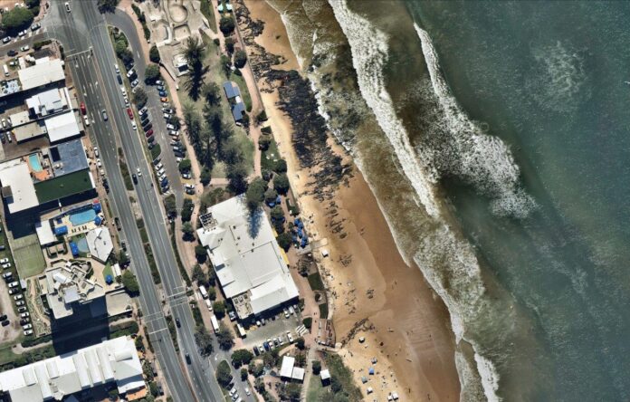
Tropical Cyclone Alfred might now be a distant memory, but beaches on the Sunshine Coast are still showing the signs of being battered by heavy swell, strong winds and heavy rain for days.
The event in early March caused significant erosion at several locations, most notably at Yaroomba, Maroochydore, Kings Beach and along the exposed Kawana stretch.
It also led to the creation of a second tidal breakthrough near the Lions Park day-use area at Bribie Island, which is now the subject of a public review.
To show how the coastline changed as a result of the cyclone, Sunshine Coast News has partnered with Australian location intelligence company Nearmap to bring readers a series of interactive photos. Simply drag the slider across the images to compare the before and after.
The ‘before’ images are from January 21, while the ‘after’ images are from April 17. They are the closest available to when Alfred’s impacts were felt.
Related story: Shifting sands: photos show how coastline has changed
It is important to note some of the changes seen in the photos might be exaggerated by natural phenomena such as tides, swell, shadows, reflections and recent rainfall.
The images were captured by the Nearmap proprietary aerial camera system attached to planes. They are not satellite images, which is why they have higher resolution.
Alex Surf Club
Birrahl Park, Yaroomba
Related story: Timelapse video reveals ocean’s impact on island
Half Moon Bay (left) and Buddina Beach (right)
Currimundi Lake
First Bribie Island breakthrough
Second Bribie Island breakthrough
Related story: Interactive aerial imagery shows how Coast has changed
Tooway Creek and Moffat Beach
Mount Coolum boardwalk
Mudjimba Beach
Noosa River and Main Beach
Related story: Interactive aerial images show how our roads have changed
Stumers Creek
Sunshine Beach
Kings Beach
Pincushion Island
Related story: Timelapse: see how area has changed after tidal breakthrough
The aerial imagery in this story is from Australian location intelligence company Nearmap. The company provides government organisations, architectural, construction and engineering firms, and other companies, with easy, instant access to high-resolution aerial imagery, city-scale 3D content, artificial intelligence data sets, and geospatial tools to assist with urban planning, monitoring and development projects in Australia, New Zealand and North America.


