
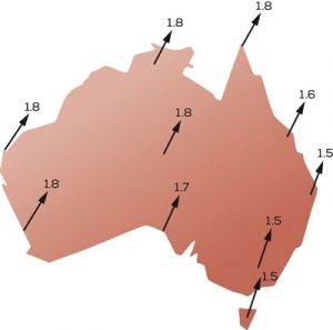
Australia sits on the fastest moving tectonic plate in the world and our continent moves approximately 7cm each year to the north-east.
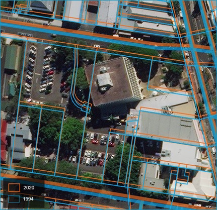
Since 1994, we’ve moved about 1.8m and while this might not sound like a big deal, it has the potential to cause major problems for equipment that relies on accurate positioning data, like mobile phones, survey instruments, and vehicle navigation devices.
To ensure the Sunshine Coast keeps its bearings and meets the requirements of the digital age, council has transitioned all of its datasets to the leading location-based information system – Geocentric Datum of Australia 2020 (GDA2020).
Outstanding Organisation Portfolio Councillor Ted Hungerford said council was one of the first local governments in Australia to transition to the new system.
“Anybody on the Sunshine Coast who uses a mobile phone or relies on location information through council’s MyMaps platform will benefit from this change,” Cr Hungerford said.
“Numerous business sectors who rely on location information and utilise council’s MyMaps service will now also have access to information that is more closely aligned with commonly used global coordinate reference systems.
“This includes the building and construction sector, agriculture, planning consultants, transport, insurance, emergency services, and telecommuncations.
“Given the shift of our continent over time, a discrepancy of around 1.8m has emerged between recorded locations and the technologies we use to navigate them.
“So this is a change that had to be made and by matching the timing of the Queensland Government’s transition to GDA2020, it will essentially be business as usual for council and the Sunshine Coast.
“We’ll continue working with one data set without the overheads or increased errors that would have been inevitable had we attempted to juggle two different data standards for a prolonged period of time.”